Upper Lehman Creek Campground
Baker, Nevada · 7,631 ft · In Great Basin National Park
Photos: NPS/Robb Reinhart
At a glance
6 of 8 facts known · recreation.gov, checked Sep 24, 2026
- Elevation
- 7,631 ft (2,326 m)7,631 ft2,326 m
Sites23
Upper Lehman Creek Campground lists no loops, so its sites are listed here. Pick a site to see its details.
- 1Standard · up to 8 people20 ft
- 2Standard · accessible · up to 8 people30 ft
- 3Standard · up to 8 people30 ft
- 4Standard · up to 8 people26 ft
- 5Standard · up to 8 people35 ft
- 6Standard · up to 8 people25 ft
- 7Standard · up to 8 people25 ft
- 8Standard · up to 8 people19 ft
- 9Standard · up to 8 people16 ft
- 10Standard · up to 8 people30 ft
Showing 10 of 23 · by site number
From recreation.gov's site list, Oct 10, 2026.
Other campgrounds in Great Basin National Park 12
Nearest first. Every place inside the park's boundary.
- Lower Lehman Creek Campground20 sites · $20 a night · Reserve on Recreation.gov0.5 mi
- Dump Station$10 a night1.8 mi
- Baker Creek Campground37 sites · $20 a night · Reserve on Recreation.gov1.9 mi
- Grey Cliffs Campground3 loops · Loop A, Loop B, Loop C · 16 sites · $20 a night · Reserve on Recreation.gov2.2 mi
- Wheeler Peak Campground37 sites · $20 a night · partial hookups · Reserve on Recreation.gov3.0 mi
- Shoshone 1Campground · facts not yet known5.8 mi
Also in the park: Group area: Pinnacle Group Campsite 8.1 mi · Group area: Monkey Rock Group Campsite 8.6 mi
Open the park pageAmenities
From National Park Service — campgrounds, OpenStreetMap, Overture Maps Foundation — Places, Recreation.gov, Recreation.gov — campground rate cards · Correct
- ADA accessible
- Campfires allowed
- Pull-through sites
- Toilets
From National Park Service — campgrounds, OpenStreetMap, Overture Maps Foundation — Places, Recreation.gov, Recreation.gov — campground rate cards
You could be the first camper hereYou could be the first camper on this page
Stayed here? Share what the next camper should know.
Free account · no email needed to browse
About
Overview
Whether you prefer the rich smell of summer mahogany riding air currents blended with the vanilla of ponderosa pine, or the sound of a clear mountain stream babbling beneath a symphony of swaying white fir, you won't regret your stay at Upper Lehman Creek Campground. At 7500 feet in elevation and three miles up the Wheeler Peak Scenic Drive a stay at Upper Lehman puts you within a ten-minute drive of Lehman Caves and just a brief cruise from high alpine trails that will take you into the heart of the Snake Range. A stroll across the grounds may present you with mule deer or turkey, while a step out onto the viewing platform over Lehman Creek could offer a glimpse of cutthroat trout moving gracefully through a liquid stage.
Recreation
For guests at Upper Lehman Creek Campground a number of recreational options present themselves.
From National Park Service — campgrounds, OpenStreetMap, Overture Maps Foundation — Places, Recreation.gov, and Recreation.gov — campground rate cards · · Edit
Cell service
Report signal- VerizonNo coverage on FCC map
- AT&TNo coverage on FCC map
- T-Mobile5G · 4G LTE
Cell service at Upper Lehman Creek Campground: FCC map Dec 2025
Weather
National Weather Service
- TuePartly Sunny, 9% chance of rain36°28°
- WedSunny45°32°
- ThuSunny47°34°
- FriSunny, 1% chance of rain52°36°
- SatSunny54°37°
Nearby camping
SeeSee all on the mapOutside the park, nearest first.
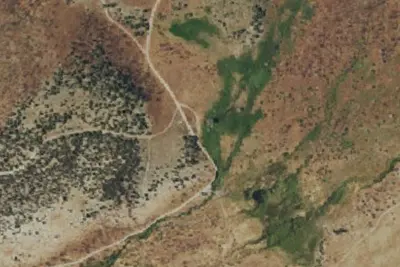
Camp site
Campground · 3.8 mi · Baker
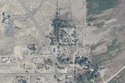
Whispering Elms Campground
Campground · 6.8 mi · Baker
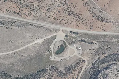
Sacramento Pass Recreation Area
Public Land · 8.1 mi · Baker
3 more within 25 mi
Dispersed camping nearby
Free dispersed camping within 19 mi, on public land.
- 6.4 mi
Eagle Peak Campsites
Baker, NV · On National Park Service land · Great Basin National Park
- 7.1 mi
Squirrel Springs Campsites
Baker, NV · On National Park Service land · Great Basin National Park
- 7.9 mi
Snake Creek Campsite
Baker, NV · On National Park Service land · Great Basin National Park
- 8.1 mi
Pinnacle Group Campsite
Baker, NV · On National Park Service land · Great Basin National Park
- 8.6 mi
Monkey Rock Group Campsite
Baker, NV · On National Park Service land · Great Basin National Park
- 9.2 mi
Snake Creek
Baker, NV · On Bureau of Land Management land · Bristlecone Field Office
Location and contact
Data from National Park Service — campgrounds (NPS Data API), OpenStreetMap, Overture Maps Foundation — Places, Recreation Information Database (RIDB) / Recreation.gov, Recreation.gov — campground rate cards
Something wrong here? Suggest an edit
Run this campground? Claim the listing