Mount Rainier National Park
5 campgrounds in the park · 265 nearby · 170 free and dispersed sites within 50 mi
Photo: JD Hascup Photo
8 current alerts
As of Sep 20, 2026 · from nps.gov
- DangerWILDFIRE CLOSURES: Sunrise & northern trails. White River open.Due to several active fires on the north side of the park, the following closures are in effect until further notice: Grand Park area & trails, Northern Loop Trail, Wonderland Trail from Carbon River Suspension Bridge to Frozen Lake, & associated backcountry campgrounds. White River Road & WR Campground reopened along with White River/Sunrise Trails. Sunrise Rd CLOSED to vehicles; open for pedestrians/bicycling only.
- CautionAir quality impacted by wildfire smoke.Smoke from regional wildfires is affecting air quality in the park. When air quality is a concern: 1. monitor air quality and smoke forecasts; 2. assess your own sensitivity to poor air quality, and the sensitivity of others in your group; 3. adjust outdoor activities as needed.
- CautionBe cautious around park rivers & learn how to cross safely!Many hikers underestimate the power of moving water. Regardless of your knowledge, skills, and experience use these pointers in making wise decisions before attempting to cross a river.
- CautionParkwide Fire Ban in effect until further notice beginning June 26Beginning Friday 6/26/26 until rescinded, a parkwide fire ban is implemented for all campfires & the ignition of wood, briquettes, or any fuel in fire pits, fire pans, & BBQ grills.
- InformationYour GPS May Be WrongThere are five entrances to the park. GPS may take you to the wrong entrance or attempt to follow the most direct route, which could lead to closed gates. It can take hours to reroute to the correct entrance. Check directions & maps, not just your GPS.
- InformationExpect long lines at entrances on weekends.Lengthy delays are likely at the southwest park entrance on SR706 on weekends. Check Google Maps for backup (represented by the orange/red line) at link below. Please do not block driveways or roads while in line outside the park.
- InformationOhanapecosh Campground area closed for construction in 2026.The entire Ohanapecosh Campground area is CLOSED for the duration of the construction project, including all campsites, visitor center, restrooms, picnic area, & Ohanapecosh river access.
- Park closureSR 165 Carbon River/Fairfax Bridge is closed: no access to Carbon River or Mowich Lake.There is NO public access to Carbon River & Mowich Lake from SR 165. The bridge is closed to pedestrians, bicycles and vehicles and there is no alternate route.
At a glance
- Entrance
- $30 per vehicle
- Open
- Year-round
- In the park
- 5 campgroundsAll reserve on Recreation.gov
- Near the park
- 265 campgroundsWithin 50 mi
- Free and dispersed
- 170 sitesWithin 50 mi
- Annual pass
- $55Mount Rainier only
Where to camp
Camping in the park 5
- National Park
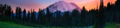
Cougar Rock Group Campground
In the park · Ashford, WA
Reserve on Recreation.gov
- National Park
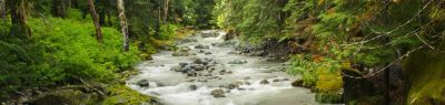
Ohanapecosh Campground
In the park · Packwood, WA
Reserve on Recreation.gov
Camping near the park 265
- Aerial viewCampground
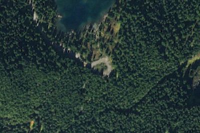
Mowich Lake Campground
9.0 mi · Carbonado, WA
- Aerial viewCampground
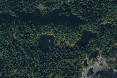
Golden Lakes Camp
9.4 mi · Ashford, WA
Free and dispersed nearby 170
See them on the map- Camp CurtisAshford, WA1.3 mi
- Camp SchurmanAshford, WA1.5 mi
- Ingraham FlatsAshford, WA1.8 mi
- Glacier Basin CampMount Rainier, WA2.0 mi
- Camp MuirAshford, WA2.2 mi
- Camp SummerlandMount Rainier, WA2.2 mi
Services nearby: 25 dump stations · 9 rest areas
About Mount Rainier
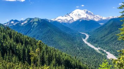
Ascending to 14,410 feet above sea level, Mount Rainier stands as an icon in the Washington landscape. An active volcano, Mount Rainier is the most glaciated peak in the contiguous U.S.A., spawning five major rivers. Subalpine wildflower meadows ring the icy…
Ascending to 14,410 feet above sea level, Mount Rainier stands as an icon in the Washington landscape. An active volcano, Mount Rainier is the most glaciated peak in the contiguous U.S.A., spawning five major rivers. Subalpine wildflower meadows ring the icy volcano while ancient forest cloaks Mount Rainier’s lower slopes. Wildlife abounds in the park’s ecosystems. A lifetime of discovery awaits.
Photos: NPS Photo / E. Brouwer · NPS Photo · NPS Photo / Steve Redman
Things to do
- Auto and ATV
- Scenic Driving
- Astronomy
- Stargazing
- Biking
- Camping
- Backcountry Camping
- Car or Front Country Camping
- Group Camping
Plan your visit
Getting there
Mount Rainier National Park is located in west-central Washington state. Several major cities in Washington- Seattle, Tacoma, and Yakima- and Portland, Oregon, are within 200 miles of the park. For GPS to Nisqually…
Weather
Weather patterns at Mount Rainier are strongly influenced by the Pacific Ocean and elevation. The climate is generally cool and rainy, with summer highs in the 60s and 70s. While July and August are the sunniest months…
Plan your visit
Fees and passes
- Private vehicle$30
- Per person$15
- Motorcycle, 7 days$25
- Mount Rainier annual pass$55
Hours
Mount Rainier National Park is open all year. Visitation peaks in July and August with warmer weather and blooming wildflowers. In spring and autumn, weather determines the availability of facilities and roads. During winter months a number of roads, facilities, and entrances close for the season.
Getting there
Mount Rainier National Park is located in west-central Washington state. Several major cities in Washington- Seattle, Tacoma, and Yakima- and Portland, Oregon, are within 200 miles of the park. For GPS to Nisqually Entrance use: 39000 State Route 706 E, Ashford, WA 98304.
Weather
Weather patterns at Mount Rainier are strongly influenced by the Pacific Ocean and elevation. The climate is generally cool and rainy, with summer highs in the 60s and 70s. While July and August are the sunniest months of the year, rain is very likely in spring, fall, and winter. Visitors should be aware that mountain weather is very changeable. In the higher elevations, like Paradise, winter can last from November to May with many feet of snow on the ground.
Camped at Mount Rainier? You could be the first to say which site you'd pick again.
Reviews, photos and cell signal reports from real stays help the next camper choose between Cougar Rock Group Campground, Ohanapecosh Campground and Ohanapecosh Group Campground.