Ice Age National Scenic Trail
71 nearby · 1 free and dispersed site within 25 mi
Photo: NPS Photo / Billy Flynn
11 current alerts
As of Sep 20, 2026 · from nps.gov
- CautionUse Caution — Milwaukee River SegmentLogging operations are occurring along a 0.3‑mile section of the Trail about 0.2 miles north of Hwy 28. Work may continue into winter. Heavy machinery may be present. Use caution. For maps and additional details from the Ice Age Trail Alliance, follow the link below:
- CautionUse Caution — Devil's Lake SegmentHwy 113 is undergoing a repaving project. The Ice Age Trail remains open, but the Hwy 113 crossing will be temporarily closed during paving work. Expect construction vehicles and limited parking access between CTH‑DL (north side) and Solum Ln. The project is anticipated to continue through mid‑November. For maps and additional details from the Ice Age Trail Alliance, follow the link below:
- InformationReroute in Effect — Baraboo SegmentThe Ice Age Trail is closed along Effinger Rd for repaving. Follow the posted detour, which directs hikers south from STH‑113 (Water St) on a paved path, then along Mill Race Dr to Manchester St. The closure is anticipated to last until October. For maps and additional details from the Ice Age Trail Alliance, follow the link below:
- InformationReroute in Effect — Montello SegmentA portion of the Ice Age Trail and the Krakow Park parking area on the north side of the lock channel below the Montello Dam are closed during reconstruction through June 2027. Eastbound hikers should bypass the closure via the mulched path from the boat launch, then follow the dirt driveway, pass through the adjacent parking area, and turn south on Main St (Hwy 22). For maps and additional details from the Ice Age Trail Alliance, follow the link below:
- InformationReroute in Effect — Skunk and Foster Lakes SegmentA reroute is in effect between Indian Valley Rd and Grenlie Rd from September 1, 2026 to January 5, 2027 due to private hunting. Bypass the closure by heading southwest, then south on N Foley Rd, and turning east on Grenlie Rd. The section between Grenlie Rd and Rieben Rd is also closed during the 9‑day gun deer season. For maps and additional details from the Ice Age Trail Alliance, follow the link below:
- InformationReroute in Effect — Thornapple Creek SegmentThe first 0.4 miles east of Thornapple Creek Rd are closed September 1–December 31 for private hunting. Bypass the closure by heading west, then south on Thornapple Creek Rd, and turning east on Gold Dust Rd. For maps and additional details from the Ice Age Trail Alliance, follow the link below:
- InformationReroute in Effect — Algoma Connecting Route SegmentA reroute is in effect on the connecting route south of Algoma. The bridge over Three Mile Creek on Longfellow Rd is closed to all travel. Bypass this closure via 9th Rd and STH‑42; note that the 10th Rd bridge is also closed. This 2.7‑mile alternate route replaces 2.8 miles of connecting route. For maps and additional details from the Ice Age Trail Alliance, follow the link below:
- InformationReroute in Effect — Sturgeon Bay SegmentA 0.1‑mile section of the Ice Age Trail between S Neenah Ave and W Yew St is closed indefinitely. Bypass this closure via S Neenah Ave and W Yew St. This 0.5‑mile alternate route replaces 0.5 miles of Ice Age Trail. For maps and additional details from the Ice Age Trail Alliance, follow the link below:
- CautionUse Caution — Tisch Mills SegmentFlooding may occur between Mill Rd. and Nuclear Rd., especially in spring or after heavy rain. A bypass is available via CTH‑B between CTH‑BB and Nuclear Rd. For maps and additional details from the Ice Age Trail Alliance, follow the link below:
- InformationReroute in Effect — Monticello SegmentThe Stewart Tunnel is closed indefinitely pending reconstruction. The Ice Age Trail is closed at both intersections of Tunnel Rd. Follow Tunnel Rd to bypass the closure and remain on the designated alternate route. For maps and additional details from the Ice Age Trail Alliance, follow the link below:
- InformationReroute in Effect — Hartman Creek SegmentA reroute is in effect between the Emmons Creek Fishery Area and Hartman Creek State Park due to forestry operations. Follow posted signage to remain on the designated reroute. For maps and additional details from the Ice Age Trail Alliance, follow the link below:
At a glance
- Open
- Year-round
- Near the park
- 71 campgroundsWithin 25 mi
- Free and dispersed
- 1 siteWithin 25 mi
Where to camp
Camping near the park 71
- Aerial viewCampground
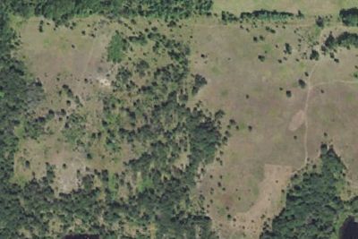
Karner Meadow DCA
1.8 mi · Coloma, WI
- Aerial viewRV Park
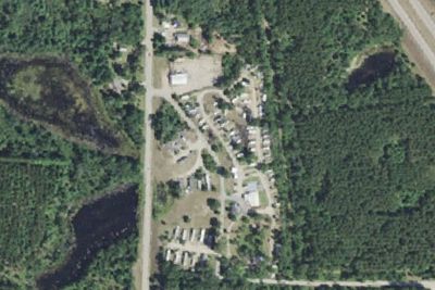
RV park
2.9 mi · Coloma, WI
Free and dispersed nearby 1
See them on the mapServices nearby: 5 dump stations · 5 rest areas
About Ice Age
The Ice Age National Scenic Trail spans 1,200 miles, traverses some of Wisconsin's finest geologic and glacial features, and passes through the ancestral lands of 15 Tribes. The Trail is built, managed and maintained by dedicated volunteers, Ice Age Trail…
The Ice Age National Scenic Trail spans 1,200 miles, traverses some of Wisconsin's finest geologic and glacial features, and passes through the ancestral lands of 15 Tribes. The Trail is built, managed and maintained by dedicated volunteers, Ice Age Trail Alliance, Wisconsin Department of Natural Resources, local partners, and the National Park Service.
Photos: NPS Photo / Billy Flynn
Things to do
- Camping
- Backcountry Camping
- Fishing
- Hands-On
- Volunteer Vacation
- Hiking
- Skiing
- Cross-Country Skiing
- Snowshoeing
Plan your visit
Getting there
Ice Age National Scenic Trail spans nearly 1,200 miles across Wisconsin. Major commercial airports are located in cities and regional hubs throughout the state, offering access to the trail. Numerous trailheads with…
Weather
Wisconsin has four distinct seasons. Summers are generally warm, while winters are cold, often bringing significant snowfall. Weather conditions can vary widely throughout the year and location on the trail. Prepare…
Plan your visit
Hours
The Ice Age National Scenic Trail is not your 'typical' park. The trail is almost 1,200 miles long and crosses the state of Wisconsin north to south and east to west. The Trail is open year round. However some segments may be closed during Wisconsin's November 9-day gun deer hunting season. Additional information about hunting seasons, trail conditions and closures along the rest of the trail is available from the Wisconsin Department of Natural Resources and the Ice Age Trail Alliance.
Getting there
Ice Age National Scenic Trail spans nearly 1,200 miles across Wisconsin. Major commercial airports are located in cities and regional hubs throughout the state, offering access to the trail. Numerous trailheads with parking are available, allowing you to explore the trail at various entry points along the route.
Weather
Wisconsin has four distinct seasons. Summers are generally warm, while winters are cold, often bringing significant snowfall. Weather conditions can vary widely throughout the year and location on the trail. Prepare accordingly for each season when visiting the Ice Age National Scenic Trail.
Camped at Ice Age? You could be the first to say which site you'd pick again.
Reviews, photos and cell signal reports from real stays help the next camper choose.