Snag Cove Campground
Boyds, Washington · 1,299 ft · In Lake Roosevelt National Recreation Area
Photos: NPS-LARO
At a glance
5 of 8 facts known · recreation.gov, checked Oct 3, 2026
- Elevation
- 1,299 ft (396 m)1,299 ft396 m
Sites9
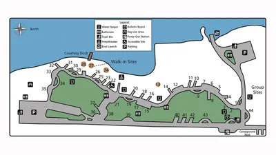
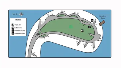
Snag Cove Campground lists no loops, so its sites are listed here. Pick a site to see its details.
- 1Standard · accessible · up to 10 people28 ft
- 2Standard · up to 10 people38 ft
- 3Standard · up to 10 people40 ft
- 4Standard · up to 10 people26 ft
- 5Standard · up to 10 people33 ft
- 6Standard · up to 10 people34 ft
- 7Standard · up to 10 people36 ft
- 8Standard · up to 10 people27 ft
- 9Standard · up to 10 people20 ft
All 9 shown · by site number
From recreation.gov's site list, Oct 10, 2026.
Amenities
From National Park Service — campgrounds, OpenStreetMap, Overture Maps Foundation — Places, Recreation.gov, Recreation.gov — campground rate cards · Correct
- Caravan / RV sites
- Tent sites
From National Park Service — campgrounds, OpenStreetMap, Overture Maps Foundation — Places, Recreation.gov, Recreation.gov — campground rate cards
You could be the first camper hereYou could be the first camper on this page
Stayed here? Share what the next camper should know.
Free account · no email needed to browse
About
Overview
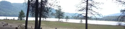
Snag Cove is a small, fairly isolated campground located on the western side of Lake Roosevelt. Eight out of the nine sites are on the lake shore and all sites are open to tents and RVs. A boat launch with trailer parking and courtesy dock frames one side of the campground. Because of its size and popularity, Snag Cove often fills in the summer.
Recreation
Snag Cove Campground is popular with families, hunters and fishermen to camp and boat. They can easily access Lake Roosevelt for shoreline fishing, or use the ramp to launch their boat.
From National Park Service — campgrounds, OpenStreetMap, Overture Maps Foundation — Places, Recreation.gov, and Recreation.gov — campground rate cards · · Edit
Cell service
Report signal- Verizon4G LTE
- AT&TNo coverage on FCC map
- T-Mobile4G LTE
Cell service at Snag Cove Campground: FCC map Dec 2025
Weather
National Weather Service
- TueSunny, 1% chance of rain60°41°
- WedMostly Sunny, 4% chance of rain65°42°
- ThuMostly Sunny66°43°
- FriSunny69°44°
- SatMostly Sunny, 3% chance of rain66°39°
Nearby camping
SeeSee all on the map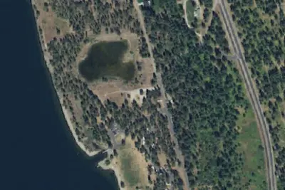
Evans Group Site
National Park · 2.9 mi · Marcus
Evans Campground
National Park · 3.1 mi · Marcus
Evans Group Camp
National Park · 3.3 mi · Boyds
3 more within 25 mi
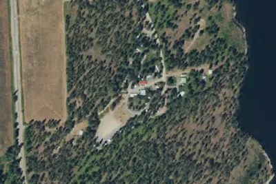
4 OpenStreetMap entries in Boyds share one park. They may be individual sites of a single campground. Suggest a merge
Location and contact
Data from National Park Service — campgrounds (NPS Data API), OpenStreetMap, Overture Maps Foundation — Places, Recreation Information Database (RIDB) / Recreation.gov, Recreation.gov — campground rate cards
Something wrong here? Suggest an edit
Run this campground? Claim the listing