Little Crater Lake
Government Camp, Oregon · 3,241 ft · In Mt. Hood National Forest
Wildfire 10 mi SW: Austin, 12,888 acres, 98% contained
At a glance
5 of 8 facts known · recreation.gov, checked Sep 24, 2026
- Elevation
- 3,241 ft (988 m)3,241 ft988 m
Sites15
Little Crater Lake lists no loops, so its sites are listed here. Pick a site to see its details.
- 001Standard · up to 6 people26 ft
- 002Standard · up to 6 people26 ft
- 003Standard · up to 6 people20 ft
- 004Standard · up to 6 people20 ft
- 005Standard · up to 6 people26 ft
- 006Standard · up to 6 people26 ft
- 007Tent only · up to 6 peopleTents only
- 008Tent only · up to 6 peopleTents only
- 009Tent only · up to 6 peopleTents only
- 010Standard · up to 6 people26 ft
Showing 10 of 15 · by site number
From recreation.gov's site list, Oct 10, 2026.
Amenities
From OpenStreetMap, Recreation.gov, Recreation.gov — campground rate cards, USDA Forest Service — Recreation Opportunities, USFS INFRA Recreation Sites · Correct
- Tent sites
From OpenStreetMap, Recreation.gov, Recreation.gov — campground rate cards, USDA Forest Service — Recreation Opportunities, USFS INFRA Recreation Sites
You could be the first camper hereYou could be the first camper on this page
Stayed here? Share what the next camper should know.
Free account · no email needed to browse
About
Overview
Little Crater Lake Campground is one of the most scenic spots in Mt. Hood National Forest and a very comfortable place to camp. It is not far from Little Crater Lake, a cold, crystal clear, spring-fed pond. Also nearby is Timothy Lake, where boaters and anglers enjoy recreating, all in the shadows of Mt. Hood, Oregon's highest point.Recreation
A short path to view Little Crater Lake begins in the campground. It connects to the Pacific Crest National Scenic Trail, which winds its way through the area, past Timothy Lake and up the slopes of Mt. Hood. The long-distance trail is popular among hikers and backpackers, stretches 2,650 miles through California, Oregon and Washington, from Canada to Mexico.
From OpenStreetMap, Recreation.gov, Recreation.gov — campground rate cards, USDA Forest Service — Recreation Opportunities, and USFS INFRA Recreation Sites · · Edit
Cell service
Report signal- Verizon4G LTE
- AT&T4G LTE
- T-MobileNo coverage on FCC map
Cell service at Little Crater Lake: FCC map Dec 2025
Weather
National Weather Service
- WedAreas Of Fog then Sunny, 6% chance of rain63°43°
- ThuSunny62°42°
- FriSunny71°41°
- SatChance Light Rain, 31% chance of rain53°34°
- SunMostly Sunny, 10% chance of rain56°36°
Nearby camping
SeeSee all on the map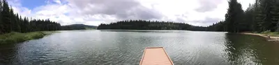
North Arm Campground (Timothy Lake, OR)
Public Land · 1.3 mi · Government Camp
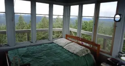
Clear Lake Cabin Lookout
Public Land · 1.4 mi · Government Camp
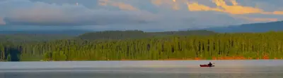
Clear Lake Butte Lookout
Other · 1.5 mi · Government Camp
3 more within 25 mi
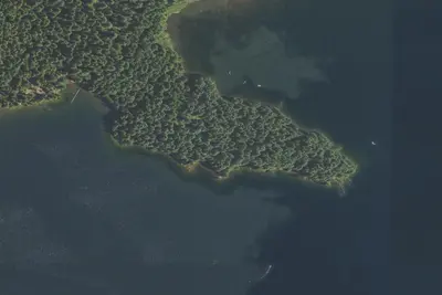
4 OpenStreetMap entries in Government Camp share one park. They may be individual sites of a single campground. Suggest a merge
Dispersed camping nearby
Free dispersed camping within 19 mi, on public land.
- 7.1 mi
Camp site
Government Camp, OR · On U.S. Forest Service land · Mt. Hood National Forest
- 9.7 mi
Goat Creek Camp
Rhododendron, OR · On U.S. Forest Service land · Mt. Hood National Forest
- 13 mi
Camp site
Government Camp, OR · On U.S. Forest Service land · Mt. Hood National Forest
- 14 mi
Camp site
Government Camp, OR · On U.S. Forest Service land · Mt. Hood National Forest
- 14 mi
Camp site
Government Camp, OR · On U.S. Forest Service land · Mt. Hood National Forest
- 14 mi
Camp site
Government Camp, OR · On U.S. Forest Service land · Mt. Hood National Forest
Location and contact
Data from OpenStreetMap, Recreation Information Database (RIDB) / Recreation.gov, Recreation.gov — campground rate cards, USDA Forest Service — Recreation Opportunities, USFS INFRA Recreation Sites
Something wrong here? Suggest an edit
Run this campground? Claim the listing