Linville Falls Campground
Crossnore, North Carolina · 3,222 ft · In Blue Ridge Parkway
Photos: Debbie Webber
At a glance
5 of 8 facts known · recreation.gov, checked Sep 24, 2026
- Elevation
- 3,222 ft (982 m)3,222 ft982 m
Loops2
Pick a loop to see its sites.
From recreation.gov's site list, Oct 10, 2026: 2 staff entries left out. Loop names are trimmed and merged.
Other campgrounds in Blue Ridge Parkway 12
Nearest first. This park is spread out: the closest is 15 miles away.
- Crabtree Falls Campground3 loops · A, B, C · 81 sites · $30 a night · Reserve on Recreation.gov16 mi
- Julian Price Memorial Park CampgroundCampground · facts not yet known16 mi
- Julian Price Campground6 loops · Loop A, Loop B, Loop C, Loop D, Loop E, Loop F · 190 sites · $30 a night · Reserve on Recreation.gov16 mi
- Doughton Park CampgroundCampground · facts not yet known54 mi
- Doughton Park CampgroundFree54 mi
- Doughton Park Campground3 loops · A, B, C · 108 sites · $30 a night · Reserve on Recreation.gov54 mi
Also in the park: 9 backcountry and High Sierra camps · 2 single sites
Open the park pageAmenities
From National Park Service — campgrounds, OpenStreetMap, Overture Maps Foundation — Places, Recreation.gov, Recreation.gov — campground rate cards · Correct
- ADA accessible
- Campfires allowed
From National Park Service — campgrounds, OpenStreetMap, Overture Maps Foundation — Places, Recreation.gov, Recreation.gov — campground rate cards
You could be the first camper hereYou could be the first camper on this page
Stayed here? Share what the next camper should know.
Free account · no email needed to browse
About
Overview
Located in a dense pine canopy, within hiking distance of Linville Gorge, and along the famous Blue Ridge Parkway, Linville Falls Campground is an ideal location for your next family camping excursion. Linville River, which winds beside the campground, is stocked for fishing, and the location is central to many area attractions including the Linville Falls waterfall, which has three waterfall overlooks in a one-mile hike.
Recreation
The Linville Falls area is a hiker's paradise, and the campground provides easy access to several trails that allow visitors to experience the stunning scenery and abundant wildlife.
From National Park Service — campgrounds, OpenStreetMap, Overture Maps Foundation — Places, Recreation.gov, and Recreation.gov — campground rate cards · · Edit
Cell service
Report signalFCC map: no coverage reported
- VerizonNo coverage on FCC map
- AT&TNo coverage on FCC map
- T-MobileNo coverage on FCC map
Cell service at Linville Falls Campground: FCC map Dec 2025
Weather
National Weather Service
- WedSunny, 1% chance of rain78°60°
- ThuSunny, 7% chance of rain76°59°
- FriSunny then Slight Chance Rain Showers, 18% chance of rain71°38°
- SatSunny, 2% chance of rain53°33°
- SunSunny53°38°
Nearby camping
SeeSee all on the mapOutside the park, nearest first.
Linville Falls Campground RV Park & Cabins
RV Park · 1.4 mi · Crossnore
Linville River Campground
Campground · 2.3 mi · Crossnore
Camp site
Dispersed · 3.9 mi · Crossnore
3 more within 25 mi
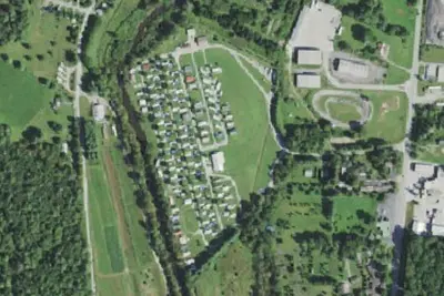
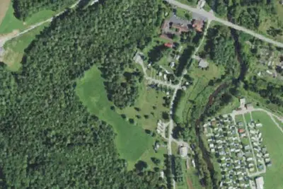
Dispersed camping nearby
Free dispersed camping within 19 mi, on public land.
- 3.9 mi
Camp site
Crossnore, NC · On U.S. Forest Service land · Pisgah National Forest
- 4.0 mi
Camp site
Crossnore, NC · On U.S. Forest Service land · Pisgah National Forest
- 5.0 mi
Camp site
Spruce Pine, NC · On U.S. Forest Service land · Pisgah National Forest
- 5.2 mi
Camp site
Spruce Pine, NC · On U.S. Forest Service land · Pisgah National Forest
- 13 mi
Overmountain shelter camping area
Roan Mountain, NC · On U.S. Forest Service land · Pisgah National Forest
- 13 mi
Doll Flats Camping Area
Elk Park, NC · On U.S. Forest Service land · Pisgah National Forest
Location and contact
Data from National Park Service — campgrounds (NPS Data API), OpenStreetMap, Overture Maps Foundation — Places, Recreation Information Database (RIDB) / Recreation.gov, Recreation.gov — campground rate cards
Something wrong here? Suggest an edit
Run this campground? Claim the listing