Hamburger Rock Campground
Blanding, Utah · 4,856 ft · In Bears Ears National Monument
Photos: Jeff Walsh/BLM
At a glance
4 of 8 facts known · recreation.gov, checked Sep 24, 2026
- Elevation
- 4,856 ft (1,480 m)4,856 ft1,480 m
Sites10
Hamburger Rock Campground lists no loops, so its sites are listed here. Pick a site to see its details.
- 1Standard · up to 10 people
- 2Standard · up to 10 people
- 3Standard · up to 10 people
- 4Standard · up to 10 people
- 5Standard · up to 10 people
- 6Standard · up to 10 people
- 7Standard · up to 10 people
- 8Standard · up to 10 people
- 9Standard · up to 10 people
- 10Standard · up to 10 people
All 10 shown · by site number
From recreation.gov's site list, Oct 10, 2026.
Amenities
From BLM National Recreation Sites & Facilities, OpenStreetMap, Overture Maps Foundation — Places, Recreation.gov, Recreation.gov — campground rate cards · Correct
- Caravan / RV sites
- Static caravans
- Tent sites
- Toilets
From BLM National Recreation Sites & Facilities, OpenStreetMap, Overture Maps Foundation — Places, Recreation.gov, Recreation.gov — campground rate cards
You could be the first camper hereYou could be the first camper on this page
Stayed here? Share what the next camper should know.
Free account · no email needed to browse
About
Overview
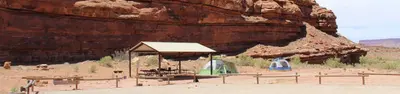
Hamburger Rock Campground is a good option for visitors wishing to recreate in the Indian Creek area of Bears Ears National Monument or be close to the Needles District of Canyonlands National Park. The campground is located north off the Needles Highway (accessed from Utah State Route 211), approximately 3 miles southeast of Canyonlands National Park and 17 miles northwest of Newspaper Rock. The campground provides 10 campsites that each feature a tent/trailer space, a picnic table, a fire ring, and vault toilets. Each campsite can hold 10 people and 2 vehicles. There is no drinking water at the campground. Reservations are not available for camping at this location. Campsites are available on a first come, first served basis upon arrival at the self-register kiosk at the site. The Indian Creek area is generally primitive and undeveloped, with few services.
Recreation
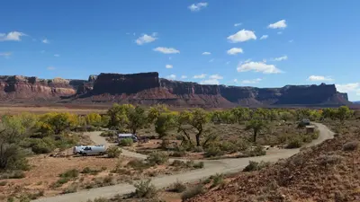
The Indian Creek area of Bears Ears National Monument has gained international recognition for its extraordinary natural beauty and recreational opportunities. The Indian Creek canyon opens to a broad valley rimmed by Wingate Sandstone cliffs known for world-class rock climbing. Prominent geologic features include Lavender Mesa, Bridger Jack Mesa, and North and South Six Shooter Peaks. This spectacular setting and rich archeological resources provide visitors with recreational opportunities such as rock climbing, camping, cultural resource viewing, scenic photography, and off-highway vehicle (OHV) touring on designated routes.
From BLM National Recreation Sites & Facilities, OpenStreetMap, Overture Maps Foundation — Places, Recreation.gov, and Recreation.gov — campground rate cards · · Edit
Cell service
Report signalFCC map: no coverage reported
- VerizonNo coverage on FCC map
- AT&TNo coverage on FCC map
- T-MobileNo coverage on FCC map
Cell service at Hamburger Rock Campground: FCC map Dec 2025
Weather
National Weather Service
- TueShowers And Thunderstorms Likely, 56% chance of rain59°43°
- WedShowers And Thunderstorms, 95% chance of rain55°41°
- ThuMostly Sunny, 4% chance of rain62°40°
- FriSunny63°43°
- SatMostly Sunny, 7% chance of rain64°45°
Nearby camping
SeeSee all on the map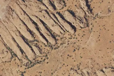
Camp site
Dispersed · 0.8 mi · Blanding
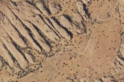
Camp site
Dispersed · 0.8 mi · Blanding
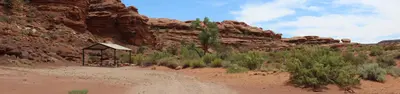
Indian Creek Falls Group Site
Public Land · 1.0 mi · Blanding
3 more within 25 mi
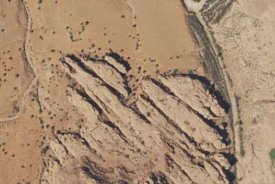
6 OpenStreetMap entries in Blanding share one park. They may be individual sites of a single campground. Suggest a merge
Dispersed camping nearby
Free dispersed camping within 19 mi, on public land.
- 0.8 mi
Camp site
Blanding, UT · On Bureau of Land Management land · Monticello Field Office
- 0.8 mi
Camp site
Blanding, UT · On Bureau of Land Management land · Monticello Field Office
- 1.2 mi
Camp site
Blanding, UT · On Bureau of Land Management land · Monticello Field Office
- 7.0 mi
Peekaboo Campsite 1
Blanding, UT · On National Park Service land · Canyonlands National Park
- 7.1 mi
Peekaboo Campsite 2
Blanding, UT · On National Park Service land · Canyonlands National Park
- 7.1 mi
Peekaboo Camp
Blanding, UT · On National Park Service land · Canyonlands National Park
Location and contact
Data from BLM National Recreation Sites & Facilities, OpenStreetMap, Overture Maps Foundation — Places, Recreation Information Database (RIDB) / Recreation.gov, Recreation.gov — campground rate cards
Something wrong here? Suggest an edit
Run this campground? Claim the listing