Digit Point Campground
Chemult, Oregon · 5,679 ft
Aerial view · USGS / USDA NAIP · Public domain · source
At a glance
4 of 8 facts known · Forest Service data, checked Oct 3, 2026
- Elevation
- 5,679 ft (1,731 m)5,679 ft1,731 m
- Land
- Winema National Forest
U.S. Forest Service
Amenities
From OpenStreetMap, USDA Forest Service — Recreation Opportunities, USFS INFRA Recreation Sites · Correct
- Campfires allowed
- Campfires allowed
- Dump station
- Tent sites
- Toilets
From OpenStreetMap, USDA Forest Service — Recreation Opportunities, USFS INFRA Recreation Sites
You could be the first camper hereYou could be the first camper on this page
Stayed here? Share what the next camper should know.
Free account · no email needed to browse
About
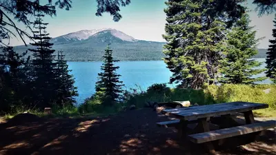
For outdoor enthusiasts looking for a campground in a peaceful forest setting with great fishing and a variety of hiking opportunities, Digit Point Campground is the place. This scenic campground is located on the south shore of Miller Lake 40 minutes east of Chemult, Oregon. The location of the campground places many campsites on the lake shore with scenic views of the lake and Mt. Thiels¿¿en. A dense growth of mixed conifers including hemlock, white pine, white fir and sugar pine, provide ample shade. Osprey, eagles, loons and grebes are local residents. June and July are heavy mosquito months, so bring bug spray. The best part about camping at Digit Point is that it offers a full array of ac¿¿tivities including biking boating, fishing, hiking and swimming. Miller Lake 's brown, rainbow and brook trout and Kokanee salmon pose a challenge for anglers of any age. A person can also fish 24 hours a day here. The Miller Lake Trail loop provides hikers an opportunity to explore part of Mt. Thielsen Wilderness and be back at camp for dinner. This five-mile loop trail also allows hikers to access the Pacific Crest National Scenic Trail; and Maidu Trail. Amenities include picnic tables, potable water, campfire rings, three flush toilets, one vault toilet and an RV dump station.
Fees: Overnight Use:
From OpenStreetMap, USDA Forest Service — Recreation Opportunities, and USFS INFRA Recreation Sites · · Edit
Cell service
Report signalFCC map: no coverage reported
- VerizonNo coverage on FCC map
- AT&TNo coverage on FCC map
- T-MobileNo coverage on FCC map
Cell service at Digit Point Campground: FCC map Dec 2025
Weather
National Weather Service
- WedSunny, 2% chance of rain61°38°
- ThuSunny64°39°
- FriSunny67°38°
- SatMostly Sunny59°33°
- SunSunny, 1% chance of rain57°32°
Nearby camping
SeeSee all on the map
Corral Springs Campground
Public Land · 7.5 mi · Chemult
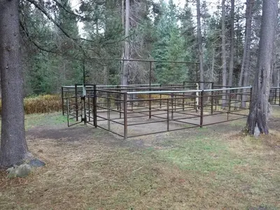
Kelsay Valley Horse Camp
Public Land · 9.1 mi · Crescent Lake
Kelsay Valley Trailhead Campground
Campground · 9.1 mi · Crescent Lake
3 more within 25 mi
Dispersed camping nearby
Free dispersed camping within 19 mi, on public land.
- 11 mi
Crystal Springs
North Umpqua, OR
- 11 mi
Linda Lake
Crescent Lake, OR
- 13 mi
Clearwater Falls Campground
North Umpqua, OR · On U.S. Forest Service land · Umpqua National Forest
- 18 mi
Clearwater #1 Forebay Forest Camp
North Umpqua, OR
- 18 mi
Grouse Hill Backcountry Campsite
Crescent Lake, OR · On National Park Service land · Crater Lake National Park
Location and contact
Data from OpenStreetMap, USDA Forest Service — Recreation Opportunities, USFS INFRA Recreation Sites
Something wrong here? Suggest an edit
Run this campground? Claim the listing