Wyeth Campground
Carson, Oregon · 174 ft · In Columbia River Gorge National Scenic Area
Photos: USFS
Wildfire 19 mi NW: High Lava, 2,899 acres, 95% contained
At a glance
7 of 8 facts known · recreation.gov, checked Sep 24, 2026
- Elevation
- 174 ft (53 m)174 ft53 m
Sites16
Wyeth Campground lists no loops, so its sites are listed here. Pick a site to see its details.
- 01Standard · accessible · up to 12 people30 ft
- 02Standard · accessible · up to 12 people30 ft
- 03Standard · accessible · up to 12 people30 ft
- 04Standard · up to 12 people20 ft
- 05Standard · up to 12 people20 ft
- 06Standard · accessible · up to 12 people30 ft
- 07Standard · accessible · up to 12 people26 ft
- 08Standard · up to 12 people20 ft
- 09Standard · accessible · up to 12 people20 ft
- 10Standard · accessible · up to 12 people30 ft
Showing 10 of 16 · by site number
From recreation.gov's site list, Oct 10, 2026.
Amenities
From OpenStreetMap, Overture Maps Foundation — Places, Recreation.gov, Recreation.gov — campground rate cards, USDA Forest Service — Recreation Opportunities, USFS INFRA Recreation Sites · Correct
- Caravan / RV sites
- Drinking water
- Tent sites
- Toilets
- Reservations (recommended)
From OpenStreetMap, Overture Maps Foundation — Places, Recreation.gov, Recreation.gov — campground rate cards, USDA Forest Service — Recreation Opportunities, USFS INFRA Recreation Sites
You could be the first camper hereYou could be the first camper on this page
Stayed here? Share what the next camper should know.
Free account · no email needed to browse
About
Overview
Wyeth Campground is just off of Interstate 84 in a forested setting with grassy fields. There are 13 individual sites, three group sites, and a camp host. In the past this site was a Seed Kiln, Guard Station, Church camp, Civilian Conservation Corps camp and Conscientious Objector Camp during World War II.
Recreation
The Wyeth trail and the Gorge 400 trail access wilderness, waterfalls, the Pacific Crest Trail and dispersed camping opportunities. Fishing, sea kayaking, kiteboarding and windsurfing are nearby on the Columbia River while road biking is available on the Historic Columbia River Highway bike path adjacent to the campground. Please note that the Wyeth Trail #411 is closed indefinitely due to damage sustained during the Eagle Creek fire of 2017.
From OpenStreetMap, Overture Maps Foundation — Places, Recreation.gov, Recreation.gov — campground rate cards, USDA Forest Service — Recreation Opportunities, and USFS INFRA Recreation Sites · · Edit
Cell service
Report signal- Verizon4G LTE
- AT&T4G LTE
- T-Mobile5G · 4G LTE
Cell service at Wyeth Campground: FCC map Dec 2025
Weather
National Weather Service
- WedMostly Sunny, 6% chance of rain68°54°
- ThuSunny68°53°
- FriSunny70°54°
- SatChance Light Rain then Partly Sunny, 32% chance of rain62°47°
- SunMostly Sunny, 3% chance of rain62°49°
Nearby camping
SeeSee all on the map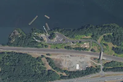
Camp site
Campground · 0.2 mi · Carson
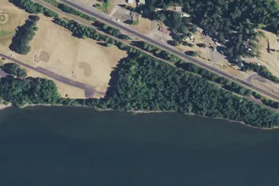
Home Valley Campground
Campground · 1.3 mi · Carson
Deadwood Camp
Campground · 1.4 mi · Cascade Locks
3 more within 25 mi
Dispersed camping nearby
Free dispersed camping within 19 mi, on public land.
- 7.6 mi
Camp site
Cascade Locks, OR · On U.S. Forest Service land · Mt. Hood National Forest
- 7.6 mi
Camp site
Cascade Locks, OR · On U.S. Forest Service land · Mt. Hood National Forest
- 7.7 mi
Camp site
Cascade Locks, OR · On U.S. Forest Service land · Mt. Hood National Forest
- 7.7 mi
Camp site
Cascade Locks, OR · On U.S. Forest Service land · Mt. Hood National Forest
- 8.1 mi
Wy'East Camp
Cascade Locks, OR · On U.S. Forest Service land · Mt. Hood National Forest
- 8.1 mi
Eagle Creek Campground
North Bonneville, OR · On U.S. Forest Service land · Mt. Hood National Forest
Location and contact
Data from OpenStreetMap, Overture Maps Foundation — Places, Recreation Information Database (RIDB) / Recreation.gov, Recreation.gov — campground rate cards, USDA Forest Service — Recreation Opportunities, USFS INFRA Recreation Sites
Something wrong here? Suggest an edit
Run this campground? Claim the listing