DispersedPublic land
Turnour Island BCMT camp
British Columbia, Canada · 0 m
At a glance
1 of 8 facts known · from OpenStreetMap and USGS
- Elevation
- 0 m (0 ft)0 m0 ft
Amenities
From OpenStreetMap · Correct
- Backcountry camping
From OpenStreetMap
You could be the first camper hereYou could be the first camper on this page
Stayed here? Share what the next camper should know.
Sign in to contribute
Free account · no email needed to browse
About
Shell beach at mid water levels. Rock shelf, muck at very low water. S side of peninsula preferred. Upland semi-developed tent sites on duff in open second growth forest. Additional forest sites approx. 50 -100 m uphill. Large site.
From OpenStreetMap · Edit
Weather
Open-Meteo
- TueModerate rain showers, 100% chance of rain53°48°
- WedOvercast, 98% chance of rain62°48°
- ThuFog, 6% chance of rain65°50°
- FriDense drizzle, 82% chance of rain63°52°
- SatModerate rain showers, 91% chance of rain57°43°
Nearby camping
SeeSee all on the map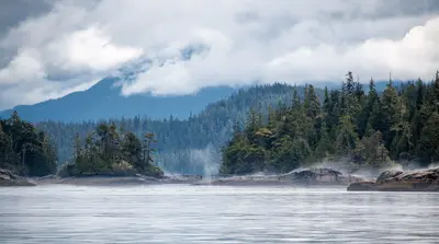
Pearl Island BCMT site
Dispersed · 3.2 km
Leone Island East (BCMT)
Dispersed · 5.6 km
Leone Island south (BCMT)
Dispersed · 5.6 km
3 more within 40 km
Location and contact
Something wrong here? Suggest an edit
Run this campground? Claim the listing