DispersedPublic land
Spiller Passage (BCMT)
British Columbia, Canada · 5 m · In Broughton Archipelago Conservancy
At a glance
1 of 8 facts known · from OpenStreetMap and USGS
- Elevation
- 5 m (16 ft)5 m16 ft
Amenities
From OpenStreetMap · Correct
- Backcountry camping
From OpenStreetMap
You could be the first camper hereYou could be the first camper on this page
Stayed here? Share what the next camper should know.
Sign in to contribute
Free account · no email needed to browse
About
White shell beach. Steep wooded 'platform' above. Access from main E beach blocked 2019 by blown down trees. May land on W side of rocky point instead. Camp in forest above. One visible tent pad. Potential for about 3 more. Kayak Bill site.
From OpenStreetMap · Edit
Weather
Open-Meteo
- TueModerate rain showers, 100% chance of rain53°48°
- WedLight drizzle, 95% chance of rain62°49°
- ThuOvercast, 2% chance of rain65°51°
- FriModerate rain showers, 86% chance of rain58°51°
- SatSlight rain showers, 98% chance of rain56°46°
Nearby camping
SeeSee all on the map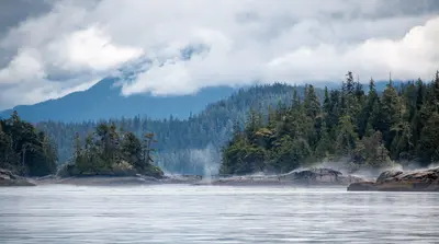
Hudson Island (BCMT)
Dispersed · 710 m
Crib Island (BCMT)
Dispersed · 2.1 km
Dusky Cove north (BCMT)
Dispersed · 2.8 km
3 more within 40 km
Location and contact
50.72079, -126.67095
Phone not yet known · Add
Park
Broughton Archipelago Conservancy
Data from OpenStreetMap
Something wrong here? Suggest an edit
Run this campground? Claim the listing