South Brush Creek Campground (WY)
Ryan Park, Wyoming · 8,323 ft · In Medicine Bow-Routt NFs & Thunder Basin NG
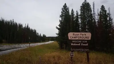
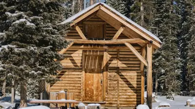
Photos: USFSMatt
At a glance
4 of 8 facts known · recreation.gov, checked Oct 3, 2026
- Elevation
- 8,323 ft (2,537 m)8,323 ft2,537 m
Sites20
South Brush Creek Campground (WY) lists no loops, so its sites are listed here. Pick a site to see its details.
- 001Standard · up to 8 people
- 002Standard · up to 8 people
- 003Standard · up to 8 people
- 004Standard · up to 8 people
- 005Standard · up to 8 people
- 006Standard · up to 8 people
- 007Standard · up to 8 people
- 008Standard · up to 8 people
- 009Standard · up to 8 people
- 010Standard · up to 8 people
Showing 10 of 20 · by site number
From recreation.gov's site list, Oct 10, 2026.
Amenities
From Recreation.gov, Recreation.gov — campground rate cards · Correct
- Campfires allowed
From Recreation.gov, Recreation.gov — campground rate cards
You could be the first camper hereYou could be the first camper on this page
Stayed here? Share what the next camper should know.
Free account · no email needed to browse
About
Overview
South Brush Creek Campground is located on the west side of the Snowy Range along the shore of South Brush Creek and is a sunny campground composed of two sections located in a dense stand of Lodgepole pines, fir and Aspen trees next to South Brush Creek. The campground has 20 sites, with 6 pull-through sites for trailers under 25 feet. Amenities include picnic tables, fire grates, toilets, trash service, and a camp host on site, and water is available late May through mid September. Pets are allowed but must be kept on a leash no longer than 6 feet and under control at all times. Many hiking, OHV, and fishing opportunities are available in the area
Recreation
The Snowy Range area in the Medicine Bow National Forest is located in southeast Wyoming. The Laramie Ranger District, Brush Creek/Hayden Ranger District, and Parks Ranger District manage portions of the Snowy Range. Year-round recreation uses include hiking, fishing, hunting, snowmobiling, skiing, OHV riding, camping, and biking. Primary access across the Snowy Range is by Highway 130, known as the Snowy Range Scenic Byway.
From Recreation.gov and Recreation.gov — campground rate cards · · Edit
Cell service
Report signalFCC map: no coverage reported
- VerizonNo coverage on FCC map
- AT&TNo coverage on FCC map
- T-MobileNo coverage on FCC map
Cell service at South Brush Creek Campground (WY): FCC map Dec 2025
Weather
National Weather Service
- WedLight Rain Likely then Rain And Snow Likely, 59% chance of rain45°27°
- ThuHeavy Snow, 90% chance of rain37°16°
- FriWidespread Frost then Sunny52°27°
- SatSunny, 1% chance of rain55°30°
- SunMostly Sunny, 1% chance of rain53°29°
Nearby camping
SeeSee all on the map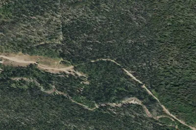
South Brush Creek Campground
Public Land · 0.4 mi · Ryan Park
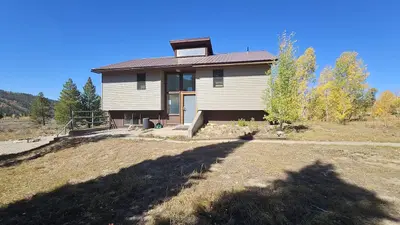
Brush Creek Work Center Barrack
Public Land · 0.9 mi · Ryan Park
Brush Creek Work Center Barracks
Other · 1.2 mi · Ryan Park
3 more within 25 mi
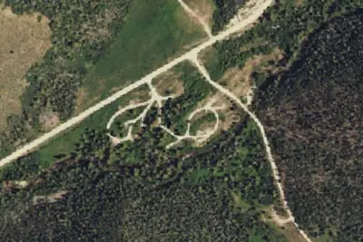
Location and contact
Data from Recreation Information Database (RIDB) / Recreation.gov, Recreation.gov — campground rate cards
Something wrong here? Suggest an edit
Run this campground? Claim the listing