Sarah's Creek Campground (Clayton, GA)
Sky Valley, Georgia · 2,041 ft · In Chattahoochee-Oconee National Forest
Photos: Chris Doing
At a glance
5 of 8 facts known · recreation.gov, checked Sep 24, 2026
- Elevation
- 2,041 ft (622 m)2,041 ft622 m
Sites19
Sarah's Creek Campground (Clayton, GA) lists no loops, so its sites are listed here. Pick a site to see its details.
From recreation.gov's site list, Oct 10, 2026: 3 staff entries left out.
Amenities
From OpenStreetMap, Recreation.gov, Recreation.gov — campground rate cards, USDA Forest Service — Recreation Opportunities, USFS INFRA Recreation Sites · Correct
- Campfires allowed
- Toilets
- Trash / dumpster
From OpenStreetMap, Recreation.gov, Recreation.gov — campground rate cards, USDA Forest Service — Recreation Opportunities, USFS INFRA Recreation Sites
You could be the first camper hereYou could be the first camper on this page
Stayed here? Share what the next camper should know.
Free account · no email needed to browse
About
Overview
Extending the same primitive feel as its neighboring West Fork Campground and the Chattooga River, Sarah's Creek 22-site developed campground offers a tranquil escape, a place to relax, and perhaps a chance to throw in a line to catch a few fish.
Recreation
Sarah's Creek Campground is in another unique area in the Chattahoochee National Forest. You can enjoy walking along the number of creeks or the Chattooga Wild and Scenic River. If some water activities are on your mind the Chattooga Wild and Scenic River has fishing, whitewater rafting, canoe, and kayak possibilities with outfitter and guide services available if you enjoy your time on the river. Tallulah Gorge State Park and historic Lakemont are also a close drive. If a hike is what you desire, take a short drive along the Warwoman Road and find yourself at many trailheads all depending on what type and how long you want your hiking adventure to be. Along with the beautiful Wild and Scenic River at the back door, the area has many hiking trails nearby. Bartram Trail, Chattooga River Trail, 3-Forks Trail, and Holcomb Creek Trail are all in the area, along with a host of waterfalls, and views abound. The state-managed Warwoman Wildlife Management Area is just a few miles to the west and to the northwest of this campground is Rabun Bald the second-highest peak in the State of Georgia at 4696' above sea level. Darnell Creek Horse Trail is located west of the campground with the Warwoman Wildlife Management area for horse and mountain bike riding.
From OpenStreetMap, Recreation.gov, Recreation.gov — campground rate cards, USDA Forest Service — Recreation Opportunities, and USFS INFRA Recreation Sites · · Edit
Cell service
Report signalFCC map: no coverage reported
- VerizonNo coverage on FCC map
- AT&TNo coverage on FCC map
- T-MobileNo coverage on FCC map
Cell service at Sarah's Creek Campground (Clayton, GA): FCC map Dec 2025
Weather
National Weather Service
- WedSunny84°62°
- ThuSunny, 1% chance of rain84°62°
- FriSunny78°44°
- SatSunny, 1% chance of rain61°40°
- SunSunny58°43°
Nearby camping
SeeSee all on the map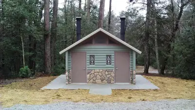
Willis Knob Horse Camp
Public Land · 3.1 mi · Sky Valley
Camp site
Dispersed · 3.1 mi · Sky Valley
Camp site
Dispersed · 3.2 mi · Sky Valley
3 more within 25 mi
Dispersed camping nearby
Free dispersed camping within 19 mi, on public land.
- 3.1 mi
Camp site
Sky Valley, GA · On State agency land · Warwoman Wildlife Management Area
- 3.2 mi
Camp site
Sky Valley, GA · On U.S. Forest Service land · Chattahoochee National Forest
- 3.3 mi
Camp site
Sky Valley, GA · On U.S. Forest Service land · Chattahoochee National Forest
- 3.3 mi
Camp site
Longcreek, GA · On U.S. Forest Service land · Chattahoochee National Forest
- 3.6 mi
Camp site
Longcreek, GA · On U.S. Forest Service land · Chattahoochee National Forest
- 3.7 mi
Campground
Sky Valley, GA · On U.S. Forest Service land · Chattahoochee National Forest
Location and contact
Data from OpenStreetMap, Recreation Information Database (RIDB) / Recreation.gov, Recreation.gov — campground rate cards, USDA Forest Service — Recreation Opportunities, USFS INFRA Recreation Sites
Something wrong here? Suggest an edit
Run this campground? Claim the listing