Rough Islets (BCMT)
British Columbia, Canada · 4 m · In Broughton Archipelago Conservancy
At a glance
1 of 8 facts known · from OpenStreetMap and USGS
- Elevation
- 4 m (13 ft)4 m13 ft
Amenities
From OpenStreetMap · Correct
- Backcountry camping
From OpenStreetMap
You could be the first camper hereYou could be the first camper on this page
Stayed here? Share what the next camper should know.
Free account · no email needed to browse
About
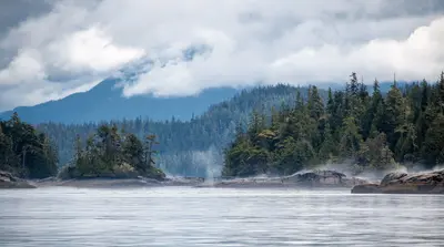
S landing in semi-enclosed cove has mostly boulder shores. E or W on cobble, small rocks. Trails on peninsula through salal to sites. 4 large wooden tent pads. Grassy areas appear damp. Pole kitchen, picnic table, fire pit. Trail to Maggy Point.
From OpenStreetMap · Edit
Weather
Open-Meteo
- TueModerate rain showers, 100% chance of rain53°49°
- WedLight drizzle, 95% chance of rain63°50°
- ThuFog, 8% chance of rain66°50°
- FriSlight rain showers, 82% chance of rain65°52°
- SatSlight rain showers, 87% chance of rain58°45°
Nearby camping
SeeSee all on the mapMaggy Point (BCMT)
Dispersed · 140 m
Lesser Berry Island (BCMT)
Dispersed · 1.6 km
Leone Island south (BCMT)
Dispersed · 2.2 km
3 more within 40 km
Location and contact
Data from OpenStreetMap
Something wrong here? Suggest an edit
Run this campground? Claim the listing