Rock Harbor Campground
Houghton, Michigan · 633 ft · In Isle Royale National Park
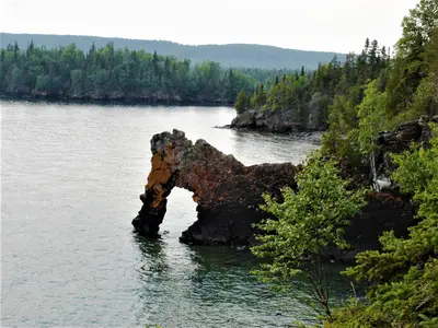
Photos: NPS / Alan West
At a glance
4 of 8 facts known · nps.gov, checked Sep 24, 2026
- Elevation
- 633 ft (193 m)633 ft193 m
- Land
- Isle Royale National Park
National Park Service
Other campgrounds in Isle Royale National Park 1
Nearest first. This park is spread out: the closest is 25 miles away.
Also in the park: 8 group areas · 37 backcountry and High Sierra camps · 1 single site
Open the park pageAmenities
From National Park Service — campgrounds, OpenStreetMap, Recreation.gov · Correct
- Backcountry camping
- Laundry
- Showers
From National Park Service — campgrounds, OpenStreetMap, Recreation.gov
You could be the first camper hereYou could be the first camper on this page
Stayed here? Share what the next camper should know.
Free account · no email needed to browse
About
Rock Harbor Campground is located in Rock Harbor on the northeast end of Isle Royale, off of the Rock Harbor and Tobin Harbor Trails. Additional fees for boats to stay overnight at marina.
Stay Limit: 1 night from June 1 – September 21 annually.
From National Park Service — campgrounds, OpenStreetMap, and Recreation.gov · · Edit
Cell service
Report signalFCC map: no coverage reported
- VerizonNo coverage on FCC map
- AT&TNo coverage on FCC map
- T-MobileNo coverage on FCC map
Cell service at Rock Harbor Campground: FCC map Dec 2025
Weather
National Weather Service
- WedPartly Sunny52°45°
- ThuCloudy then Rain Showers Likely, 62% chance of rain52°40°
- FriRain Showers Likely then Partly Sunny, 68% chance of rain49°40°
- SatSunny52°47°
- SunMostly Sunny54°47°
Nearby camping
SeeSee all on the mapOutside the park, nearest first.
Marie Louise Lake Campground
Campground · 21 mi
Camp site
Dispersed · 22 mi
Sawyer Bay Site 1
Dispersed · 23 mi
1 more within 25 mi
Dispersed camping nearby
Free dispersed camping within 19 mi, on public land.
Location and contact
Data from National Park Service — campgrounds (NPS Data API), OpenStreetMap, Recreation Information Database (RIDB) / Recreation.gov
Something wrong here? Suggest an edit
Run this campground? Claim the listing