Ridge Road
Modoc, Georgia · 358 ft · In J. Strom Thurmond Recreation Area
Photos: USACE T. Carpenter
At a glance
6 of 8 facts known · recreation.gov, checked Sep 24, 2026
- Elevation
- 358 ft (109 m)358 ft109 m
Sites66
Ridge Road lists no loops, so its sites are listed here. Pick a site to see its details.
- 003Standard · up to 12 people50 ft
- 004Standard · up to 12 people40 ft
- 005Standard · up to 12 people50 ft
- 006Standard · up to 12 people50 ft
- 007Standard · up to 12 people40 ft
- 008Standard · up to 12 people25 ft
- 009Standard · up to 12 people35 ft
- 010Standard · up to 12 people35 ft
- 011Standard · up to 12 people45 ft
- 012Standard · up to 12 people30 ft
Showing 10 of 66 · by site number
From recreation.gov's site list, Oct 10, 2026: 3 staff entries left out.
Other campgrounds in J. Strom Thurmond Recreation Area 12
Nearest first. Every place inside the park's boundary.
- Petersburg4 loops · A, B, C, PETE · $18–$32 a night · partial hookups · Reserve on Recreation.gov1.3 mi
- Lake Springs3 loops · PINE, SPRI, SQRL · $75–$125 a night · partial hookups · Reserve on Recreation.gov1.9 mi
- Below Dam South Carolina$10–$75 a night · partial hookups · Reserve on Recreation.gov3.2 mi
- Modoc$22–$64 a night · partial hookups · Reserve on Recreation.gov3.4 mi
- West Dam$10–$125 a night · partial hookups · Reserve on Recreation.gov3.6 mi
- Clarks Hill4 loops · ELIJAH COVE GROUP SHELTER, ELIJAH MINI SHELTER, HANNAH POINT SHELTER, HILLTOP SHELTER · $10–$100 a night · partial hookups · Reserve on Recreation.gov4.1 mi
Also in the park: Run by another agency: Carter Creek Camp 8.0 mi · Run by another agency: Hill Air Force Base FamCamp 8.0 mi · 1 single site
Open the park pageAmenities
From Overture Maps Foundation — Places, Recreation.gov, Recreation.gov — campground rate cards · Correct
- ADA accessible
From Overture Maps Foundation — Places, Recreation.gov, Recreation.gov — campground rate cards
You could be the first camper hereYou could be the first camper on this page
Stayed here? Share what the next camper should know.
Free account · no email needed to browse
About
Overview
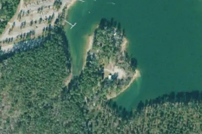
Ridge Road Campground is located on a scenic peninsula surrounded by the J. Strom Thurmond Lake, only 15 miles away from the Lake Thurmond Visitor Center and Dam and one of the area's first campgrounds.
Camping at Ridge Road is ripe with many different opportunities for relaxation, skill-building, family bonding, and nature appreciation. The 70,000 acre lake and 1,000+ miles of shoreline are prime for activities that facilitate such opportunities such as boating, water skiing, swimming, fishing, kayaking, hiking, biking, and bird watching, and so much more of course!
From Overture Maps Foundation — Places, Recreation.gov, and Recreation.gov — campground rate cards · · Edit
Cell service
Report signal- Verizon5G · 4G LTE
- AT&T5G · 4G LTE
- T-Mobile4G LTE
Cell service at Ridge Road: FCC map Dec 2025
Weather
National Weather Service
- MonSunny84°59°
- TueSunny86°62°
- WedSunny88°63°
- ThuSunny89°64°
- FriSunny, 2% chance of rain89°58°
Nearby camping
SeeSee all on the mapOutside the park, nearest first.

Camp site
Campground · 2.2 mi · Modoc

Camp site
Campground · 2.3 mi · Modoc

Camping Municipal
Campground · 2.4 mi · Modoc
3 more within 25 mi

Location and contact
Data from Overture Maps Foundation — Places, Recreation Information Database (RIDB) / Recreation.gov, Recreation.gov — campground rate cards
Something wrong here? Suggest an edit
Run this campground? Claim the listing