Mortimer Campground
Linville, North Carolina · 1,503 ft · In National Forests in North Carolina
Photos: USFS
Photos taken nearby
From Wikimedia Commons, taken close to this campground — not necessarily pictures of it.
At a glance
5 of 8 facts known · recreation.gov, checked Oct 3, 2026
- Elevation
- 1,503 ft (458 m)1,503 ft458 m
Loops2
Pick a loop to see its sites.
From recreation.gov's site list, Oct 10, 2026. Loop names are trimmed and merged.
Amenities
From OpenStreetMap, Recreation.gov, Recreation.gov — campground rate cards, USDA Forest Service — Recreation Opportunities, USFS INFRA Recreation Sites · Correct
- ADA accessible
- Campfires allowed
- Showers
- Toilets
From OpenStreetMap, Recreation.gov, Recreation.gov — campground rate cards, USDA Forest Service — Recreation Opportunities, USFS INFRA Recreation Sites
You could be the first camper hereYou could be the first camper on this page
Stayed here? Share what the next camper should know.
Free account · no email needed to browse
About
Overview
Mortimer Campground is a small campground nestled within the Wilson Creek Wild and Scenic River Corridor south of Grandfather Mountain. Located at the site of an old Civilian Conservation Corps (CCC) camp, the 17-site campground is surrounded by lush forests, gentle streams, and a large scenic river popular for swimming, fishing, and kayaking.
Recreation
Visitors to the campground can enjoy a variety of activities including fishing, swimming, day hiking, mountain biking, kayaking, picnicking, and scenic driving. Swimming holes along Thorps Creek provide wading opportunities on hot summer days. Nearby Wilson Creek, designated as a National Wild and Scenic River in 2000, is well known for its excellent trout fishing, swimming, kayaking, and rugged features. History buffs will enjoy exploring the remnants of the once booming timber town of Mortimer as well as an old CCC work center. Two Forest Service trails depart from the campground. The Thorps Creek trail provides a short (approx. 1/4 mile) hike to Thorps Creek Falls. The more strenuous Schoolhouse Ridge Trail connects to the campground via the .2 mile Bill Vines trail and provides a 3 mile ridgeline excursion with beautiful views before connecting to the Wilson Ridge Trail. Many other Forest Service trails are within a short drive of the Campground, including Hunt Fish Falls, North Harper Creek Falls, and Little Lost Cove Cliffs. The area also boasts a network of scenic mountain biking trails.
From OpenStreetMap, Recreation.gov, Recreation.gov — campground rate cards, USDA Forest Service — Recreation Opportunities, and USFS INFRA Recreation Sites · · Edit
Cell service
Report signalFCC map: no coverage reported
- VerizonNo coverage on FCC map
- AT&TNo coverage on FCC map
- T-MobileNo coverage on FCC map
Cell service at Mortimer Campground: FCC map Dec 2025
Weather
National Weather Service
- WedSunny84°60°
- ThuSunny, 4% chance of rain83°60°
- FriSunny, 6% chance of rain79°42°
- SatSunny, 3% chance of rain58°36°
- SunSunny57°39°
Nearby camping
SeeSee all on the map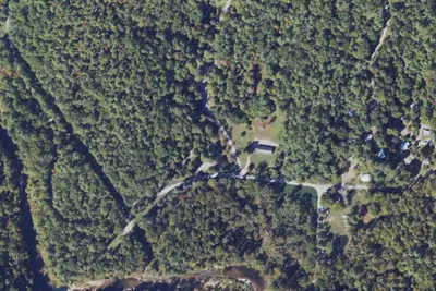
Mortimer Campground
Public Land · under 100 ft · Linville
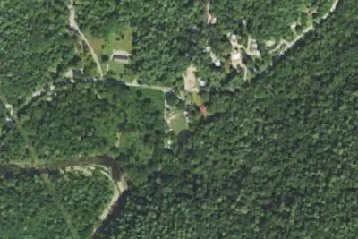
Camp site
Campground · 0.1 mi · Linville
Brown Mountain CUA Roadside Campsites
Public Land · 6.9 mi · Gamewell
3 more within 25 mi
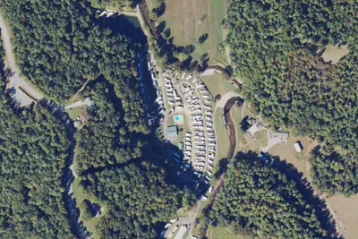
Dispersed camping nearby
Free dispersed camping within 19 mi, on public land.
- 8.5 mi
Camp site
Crossnore, NC · On U.S. Forest Service land · Pisgah National Forest
- 8.6 mi
Camp site
Crossnore, NC · On U.S. Forest Service land · Pisgah National Forest
- 9.2 mi
Camp site
Spruce Pine, NC · On U.S. Forest Service land · Pisgah National Forest
- 9.6 mi
Camp site
Spruce Pine, NC · On U.S. Forest Service land · Pisgah National Forest
- 11 mi
Old Johns River Road
Foscoe, NC · On National Park Service land · Blue Ridge Parkway
- 18 mi
Doll Flats Camping Area
Elk Park, NC · On U.S. Forest Service land · Pisgah National Forest
Location and contact
Data from OpenStreetMap, Recreation Information Database (RIDB) / Recreation.gov, Recreation.gov — campground rate cards, USDA Forest Service — Recreation Opportunities, USFS INFRA Recreation Sites
Something wrong here? Suggest an edit
Run this campground? Claim the listing