Merrisach Lake
Gillett, Arkansas · 167 ft · In Wilbur D. Mills Pool Recreation Area
Photos: USACE - Ranger Walker
Wildfire 30 mi N: Monroe 296, 16 acres
At a glance
6 of 8 facts known · recreation.gov, checked Sep 24, 2026
- Elevation
- 167 ft (51 m)167 ft51 m
Loops5
Pick a loop to see its sites.
- Loop A14 sites14 standard · up to 90 ft
- Loop B14 sites14 standard · up to 100 ft
- Loop C5 sites5 standard · up to 75 ft
- Loop D16 sites16 standard
- Loop E18 sites18 standard · up to 103 ft
Other areas
From recreation.gov's site list, Oct 10, 2026. Loop names are trimmed and merged.
Other campgrounds in Wilbur D. Mills Pool Recreation Area 2
Nearest first. Every place inside the park's boundary.
- Notrebes Bend Park$19 a night · partial hookups · Reserve on Recreation.gov3.8 mi
- Wilbur D. Mills$24 a night · partial hookups · Reserve on Recreation.gov4.3 mi
Also in the park: Group area: Pendleton Bend 6.2 mi · 3 single sites
Open the park pageAmenities
From Overture Maps Foundation — Places, Recreation.gov, Recreation.gov — campground rate cards · Correct
- Campfires allowed
From Overture Maps Foundation — Places, Recreation.gov, Recreation.gov — campground rate cards
You could be the first camper hereYou could be the first camper on this page
Stayed here? Share what the next camper should know.
Free account · no email needed to browse
About
Overview
Merrisach Lake Campground and Day Use Park is situated on the banks of Merrisach Lake and the Arkansas Post Canal in the lush bottomland forest of eastern Arkansas. The campground is described as off the beaten path, providing visitors with the peace and quiet to enjoy fishing, hunting, picnicking and boating. Recreation
The campground and day use park offers visitors the perfect amount of seclusion to enjoy the outdoors. Visitors enjoy fishing for bass, crappie and catfish in Merrisach Lake and other tributaries of Pool 2. The tailwaters of Wilbur D. Mills Dam provide excellent opportunities to catch many species of gamefish, especially catfish. Visitors to this area also find great hunting, birding and boating opportunities. Merrisach sits on the famed Mississippi Flyway, where millions of songbirds, ducks, geese and butterflies pass during migration. Facilities
From Overture Maps Foundation — Places, Recreation.gov, and Recreation.gov — campground rate cards · · Edit
Cell service
Report signal- Verizon4G LTE
- AT&T5G · 4G LTE
- T-Mobile5G · 4G LTE
Cell service at Merrisach Lake: FCC map Dec 2025
Weather
National Weather Service
- WedSunny then Slight Chance Showers And Thunderstorms, 16% chance of rain94°68°
- ThuSunny94°66°
- FriMostly Sunny78°49°
- SatSunny71°46°
- SunSunny79°54°
Nearby camping
SeeSee all on the mapOutside the park, nearest first.
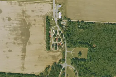
Location and contact
Data from Overture Maps Foundation — Places, Recreation Information Database (RIDB) / Recreation.gov, Recreation.gov — campground rate cards
Something wrong here? Suggest an edit
Run this campground? Claim the listing