Mammoth Cabin
Scofield, Utah · 8,599 ft · In Manti-La Sal National Forest
Photos: USFS
At a glance
4 of 8 facts known · recreation.gov, checked Sep 24, 2026
- Elevation
- 8,599 ft (2,621 m)8,599 ft2,621 m
Loops0
Pick a loop to see its sites.
From recreation.gov's site list, Oct 10, 2026. Loop names are trimmed and merged.
Amenities
From Recreation.gov, Recreation.gov — campground rate cards, USDA Forest Service — Recreation Opportunities · Correct
- Campfires allowed
- Showers
- Toilets
From Recreation.gov, Recreation.gov — campground rate cards, USDA Forest Service — Recreation Opportunities
You could be the first camper hereYou could be the first camper on this page
Stayed here? Share what the next camper should know.
Free account · no email needed to browse
About
Overview
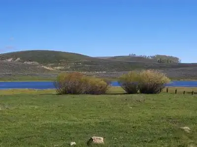
The Mammoth Guard station is located at 8,600 feet in elevation. There are two cabins on the grounds. The Mammoth Cabin was built on site while the Lake Cabin was moved to the site from its original location in the 1980s. Both cabins were constructed in the 1930s serving as forest ranger and fire crew dwellings for many years. The cabins overlook a wide expanse of sagebrush valleys with timbered slopes and ridgelines. The grounds that cabins are located is also an active administrative site. Visitors can expect to see Forest Service personnel using the grounds adjacent to the cabins.
Travel Trailers and RVs are not permitted at this facility. If others are seeking to be close to your group during your reservation they should look at the nearby campgrounds at Gooseberry Group Campground and Gooseberry Reservoir.
From Recreation.gov, Recreation.gov — campground rate cards, and USDA Forest Service — Recreation Opportunities · · Edit
Cell service
Report signalFCC map: no coverage reported
- VerizonNo coverage on FCC map
- AT&TNo coverage on FCC map
- T-MobileNo coverage on FCC map
Cell service at Mammoth Cabin: FCC map Dec 2025
Weather
National Weather Service
- WedChance Snow Showers, 40% chance of rain36°27°
- ThuMostly Sunny, 1% chance of rain44°27°
- FriSunny50°30°
- SatSunny, 1% chance of rain50°32°
- SunSunny, 1% chance of rain52°33°
Nearby camping
SeeSee all on the mapLake Cabin
Other · under 100 ft · Scofield
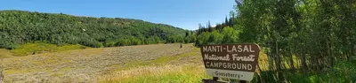
Gooseberry Creek Campground
Public Land · 0.8 mi · Scofield
Camp site
Campground · 1.1 mi · Fairview
3 more within 25 mi
5 OpenStreetMap entries in Scofield share one park. They may be individual sites of a single campground. Suggest a merge
Dispersed camping nearby
Free dispersed camping within 19 mi, on public land.
- 1.8 mi
Camp site
Fairview, UT · On U.S. Forest Service land · Manti-La Sal National Forest
- 1.8 mi
Camp site
Fairview, UT · On U.S. Forest Service land · Manti-La Sal National Forest
- 1.9 mi
Camp site
Fairview, UT · On U.S. Forest Service land · Manti-La Sal National Forest
- 1.9 mi
Camp site
Fairview, UT · On U.S. Forest Service land · Manti-La Sal National Forest
- 6.6 mi
Camp site
Clear Creek, UT · On U.S. Forest Service land · Manti-La Sal National Forest
- 6.7 mi
Camp site
Clear Creek, UT · On U.S. Forest Service land · Manti-La Sal National Forest
Location and contact
Data from Recreation Information Database (RIDB) / Recreation.gov, Recreation.gov — campground rate cards, USDA Forest Service — Recreation Opportunities
Something wrong here? Suggest an edit
Run this campground? Claim the listing