Low Gap Campground
Tate City, Georgia · 1,975 ft · In Chattahoochee-Oconee National Forest
Photos: USFS
At a glance
4 of 8 facts known · recreation.gov, checked Sep 24, 2026
- Elevation
- 1,975 ft (602 m)1,975 ft602 m
Sites13
Low Gap Campground lists no loops, so its sites are listed here. Pick a site to see its details.
From recreation.gov's site list, Oct 10, 2026.
Amenities
From Recreation.gov, Recreation.gov — campground rate cards · Correct
- Campfires allowed
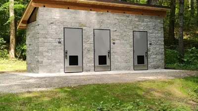
- Toilets
- Trash / dumpster
From Recreation.gov, Recreation.gov — campground rate cards
You could be the first camper hereYou could be the first camper on this page
Stayed here? Share what the next camper should know.
Free account · no email needed to browse
About
Overview
Located within the Chattahoochee National Forest and veiled by the Mark Trail Wilderness. This 13-site developed campground is as close as it gets to a dispersed camping experience with amenities. This clandestine campground is best known for its plethora of opportunities for camping, fishing, hiking, hunting, and simply basking in the light of the natural world. Low Gap Campground is located only a few miles from Georgia's much-loved vacation destination, the alpine village of Helen. A trip to this campground is sure to make memories, be sure to pack a camera and take some home with you.
Recreation
The area is host to some of the most scenic views. Or you can take a drive along FS 44 Road (Upper Chattahoochee River Road) and see some waterfalls that are along the roadway and or others a short walk in nearby areas. If hiking is in your plans the National Scenic Appalachian Trail has two main entry points near the area. Other favorite nearby hiking areas are Ravens Cliff Falls, Dukes Creek Falls, and Anna Ruby Falls. All are only a short drive from this campground. If you like wetting fishing lines there is fishing is available in the campground, and along the nearby Chattahoochee River, whose headwaters are in the Mark Trail Wilderness. Be sure you are following the state fishing licensing regulations. Drive into "Alpine" Helen try tubing and swimming on the river, or explore the unique shops and restaurants of Georgia's own Bavarian village.
From Recreation.gov and Recreation.gov — campground rate cards · · Edit
Cell service
Report signalFCC map: no coverage reported
- VerizonNo coverage on FCC map
- AT&TNo coverage on FCC map
- T-MobileNo coverage on FCC map
Cell service at Low Gap Campground: FCC map Dec 2025
Weather
National Weather Service
- WedSunny84°61°
- ThuSunny, 1% chance of rain83°61°
- FriSunny, 1% chance of rain78°43°
- SatSunny, 1% chance of rain63°40°
- SunSunny60°43°
Nearby camping
SeeSee all on the map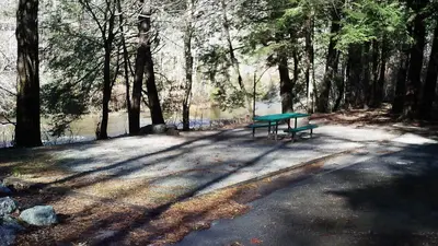
Tallulah River Campground
Public Land · 470 ft · Tate City
Nichols Campground
Campground · 0.5 mi · Tate City
Tate Branch Campground (Clayton, GA)
Public Land · 2.0 mi · Tate City
3 more within 25 mi
4 OpenStreetMap entries in Tate City share one park. They may be individual sites of a single campground. Suggest a merge
Dispersed camping nearby
Free dispersed camping within 19 mi, on public land.
- 4.4 mi
Camp site
Tate City, GA · On U.S. Forest Service land · Chattahoochee National Forest
- 5.6 mi
Camp site
Tate City, NC · On U.S. Forest Service land · Nantahala National Forest
- 7.8 mi
Camp site
Hiawassee, GA · On State agency land · Swallow Creek Wildlife Management Area
- 8.4 mi
Camp site
Hiawassee, GA · On U.S. Forest Service land · Chattahoochee National Forest
- 8.4 mi
Camp site
Hiawassee, GA · On U.S. Forest Service land · Chattahoochee National Forest
- 10 mi
Camp site
Helen, GA · On State agency land · Swallow Creek Wildlife Management Area
Location and contact
Data from Recreation Information Database (RIDB) / Recreation.gov, Recreation.gov — campground rate cards
Something wrong here? Suggest an edit
Run this campground? Claim the listing