La Prele Guard Station
Glenrock, Wyoming · 8,005 ft · In Medicine Bow-Routt NFs & Thunder Basin NG
Photos: USDA FS
Wildfire 34 mi W: Chalk Mountain, 124 acres, 91% contained
At a glance
3 of 8 facts known · recreation.gov, checked Oct 3, 2026
- Elevation
- 8,005 ft (2,440 m)8,005 ft2,440 m
Sites1
La Prele Guard Station lists no loops, so its sites are listed here. Pick a site to see its details.
All 1 shown · by site number
From recreation.gov's site list, Oct 10, 2026.
Amenities
From Recreation.gov, Recreation.gov — campground rate cards, USDA Forest Service — Recreation Opportunities · Correct
- Campfires allowed
From Recreation.gov, Recreation.gov — campground rate cards, USDA Forest Service — Recreation Opportunities
You could be the first camper hereYou could be the first camper on this page
Stayed here? Share what the next camper should know.
Free account · no email needed to browse
About
Overview
La Prele Guard Station is located south of Douglas, Wyoming in Medicine Bow-Routt National Forest. It was originally built as a remote ranger station in 1936 by the Civilian Conservation Corps and was converted into a work center when the La Prele Ranger District was discontinued in 1956. The site was listed on the National Register of Historic Places in 1994. Today, it provides a unique lodging experience and delightful spot for guests seeking recreation and relaxation in south central Wyoming. The guard station is open from late May or early June through late October each year and is accessible by car except after snow events at the beginning and end of the season. Weather and road closures may impact opening and closure dates. Many modern conveniences are provided, but guests will need to bring a few of their own supplies to make their stay comfortable. We try to keep a supply of firewood available to guests but there is no guarantee. The site now has limited propane lighting.
Please note that due to the historic nature of the facility, pets, candles or other flame producing items are not permitted in the cabin.
From Recreation.gov, Recreation.gov — campground rate cards, and USDA Forest Service — Recreation Opportunities · · Edit
Cell service
Report signalFCC map: no coverage reported
- VerizonNo coverage on FCC map
- AT&TNo coverage on FCC map
- T-MobileNo coverage on FCC map
Cell service at La Prele Guard Station: FCC map Dec 2025
Weather
National Weather Service
- WedAreas Of Fog, 84% chance of rain34°27°
- ThuLight Snow Likely then Partly Sunny, 67% chance of rain35°20°
- FriWidespread Frost then Sunny46°32°
- SatSunny51°35°
- SunSunny51°35°
Nearby camping
SeeSee all on the map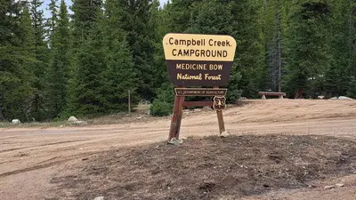
Campbell Creek Campground
Public Land · 0.2 mi · Glenrock
La Bonte 1
Campground · 8.7 mi · Esterbrook
LaBonte Camp 2
Campground · 9.0 mi · Esterbrook
3 more within 25 mi
5 OpenStreetMap entries in Glenrock share one park. They may be individual sites of a single campground. Suggest a merge
Location and contact
Data from Recreation Information Database (RIDB) / Recreation.gov, Recreation.gov — campground rate cards, USDA Forest Service — Recreation Opportunities
Something wrong here? Suggest an edit
Run this campground? Claim the listing