Joes Valley Pavilion Group Campground
Orangeville, Utah · 7,011 ft
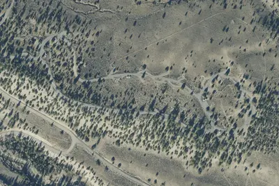
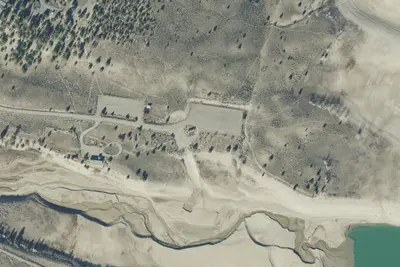
Aerial view · USGS / USDA NAIP · Public domain · source
At a glance
3 of 8 facts known · Forest Service data, checked Oct 3, 2026
- Elevation
- 7,011 ft (2,137 m)7,011 ft2,137 m
Amenities
From OpenStreetMap, USDA Forest Service — Recreation Opportunities, USFS INFRA Recreation Sites · Correct
- Group sites only
From OpenStreetMap, USDA Forest Service — Recreation Opportunities, USFS INFRA Recreation Sites
You could be the first camper hereYou could be the first camper on this page
Stayed here? Share what the next camper should know.
Free account · no email needed to browse
About
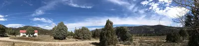
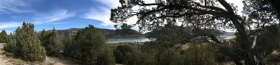
Joes Valley Pavilion Group Campground is a group campground site located at an elevation of 7,000 feet, and adjacent to Joes Valley Reservoir. Sagebrush covers the area, and a few cottonwood trees line the lakeshore. Aspen and pine trees dot the surrounding hillsides. There are no trees or natural shade in the immediate area of the campground. A large pavilion offers shade over the picnic tables only. The group campsite can accommodate up to 100 people. Vault toilets and water are provided, but no electricity is available within the group campground. A large gravel parking area provides ample space for vehicles, RVs and even tents. Visitors to this area enjoy boating, water skiing, fishing, and canoeing, as well as horseback riding, hiking and mountain biking. The reservoir offers good fishing for cutthroat, rainbow trout and trophy splake, and there is a boat ramp located nearby at Joe ' s Valley Campground. The expansive Arapeen OHV Trail System can also be accessed just west of the reservoir and provides more than 350 miles of designated, well-maintained trails that are suitable for all riding skill levels. Joe ' s Valley Resort is also nearby, offering a restaurant, a general store, and rentals for boats, personal watercraft, off-road vehicles and bikes.
Fees: Overnight Use:
From OpenStreetMap, USDA Forest Service — Recreation Opportunities, and USFS INFRA Recreation Sites · · Edit
Cell service
Report signalFCC map: no coverage reported
- VerizonNo coverage on FCC map
- AT&TNo coverage on FCC map
- T-MobileNo coverage on FCC map
Cell service at Joes Valley Pavilion Group Campground: FCC map Dec 2025
Weather
National Weather Service
- WedChance Rain And Snow Showers, 48% chance of rain42°32°
- ThuMostly Sunny, 1% chance of rain49°32°
- FriSunny53°35°
- SatSunny, 1% chance of rain54°37°
- SunSunny, 2% chance of rain55°38°
Nearby camping
SeeSee all on the map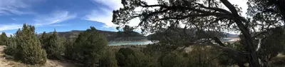
Joes Valley Pavilion Group Site a
Public Land · 130 ft · Orangeville
Orange Olsen Cabin
Other · 0.6 mi · Orangeville
Orange Olsen
Public Land · 0.7 mi · Orangeville
3 more within 25 mi
Dispersed camping nearby
Free dispersed camping within 19 mi, on public land.
- 3.3 mi
Camp site
Orangeville, UT · On U.S. Forest Service land · Manti-La Sal National Forest
- 3.5 mi
Camp site
Orangeville, UT · On U.S. Forest Service land · Manti-La Sal National Forest
- 5.4 mi
Camp site
Ephraim, UT · On U.S. Forest Service land · Manti-La Sal National Forest
- 12 mi
Camp site
Ephraim, UT · On U.S. Forest Service land · Manti-La Sal National Forest
- 12 mi
Camp site
Ephraim, UT · On U.S. Forest Service land · Manti-La Sal National Forest
- 13 mi
Camp site
Manti, UT · On U.S. Forest Service land · Manti-La Sal National Forest
Location and contact
Data from OpenStreetMap, USDA Forest Service — Recreation Opportunities, USFS INFRA Recreation Sites
Something wrong here? Suggest an edit
Run this campground? Claim the listing