Jackson Campground
Ruch, Oregon · 1,670 ft
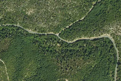
Aerial view · USGS / USDA NAIP · Public domain · source
At a glance
2 of 8 facts known · Forest Service data, checked Oct 3, 2026
- Elevation
- 1,670 ft (509 m)1,670 ft509 m
Amenities
You could be the first camper hereYou could be the first camper on this page
Stayed here? Share what the next camper should know.
Free account · no email needed to browse
About
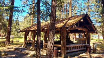
Jackson Campground sits on the shores of the Applegate River, a popular recreation site located north of the Red Buttes Wilderness Area. Visitors enjoy swimming, cycling, boating, canoeing, fishing and hiking the various trails near the river. Nearby is the inactive Bigfoot trap, built in 1974 by the North American Wildlife Research Team and found along the Collings Mountain Trail. The trap was inspired by a miner who lived near the Applegate River who claimed to have found 18-inch-long, human-like tracks in his garden. The organization operated the trap, keeping it baited with carcasses for six years, but caught only bears. Currently the Forest Service keeps an eye on the trap, but otherwise does not maintain it. It 's a popular site in the area, as it 's the only known bigfoot trap in the world! The campground has eight tent only campsites, three dry RV sites and one group site. Campsites are located along the Applegate River. Camp trailers are not recommended due to tight corners and short campsite spur lengths. The day use area is adjacent to campground. Drinking water and flush toilets are available, as well as an on-site general store. Kayak and paddle board rentals are available at Applegate, $30 for 3-hrs or $45 all-day. There is also a boat ramp offered. Please note, there is a two-night minimum when you desire to reserve a Friday or Saturday night. Rates are: Standard site: $20/night Non-electric and dry RV Sites: $20/night Group Site: $40/night Reservations are made through www.recreation.gov or by calling 1 (877) 444-6777.
Fees: Overnight Use:
From Overture Maps Foundation — Places, USDA Forest Service — Recreation Opportunities, and USFS INFRA Recreation Sites · · Edit
Cell service
Report signalFCC map: no coverage reported
- VerizonNo coverage on FCC map
- AT&TNo coverage on FCC map
- T-MobileNo coverage on FCC map
Cell service at Jackson Campground: FCC map Dec 2025
Weather
National Weather Service
- WedSunny, 2% chance of rain78°41°
- ThuSunny87°39°
- FriSunny90°39°
- SatSunny76°38°
- SunSunny, 2% chance of rain73°33°
Nearby camping
SeeSee all on the map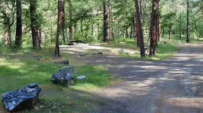
Jackson Campground on the Applegate River
Public Land · 170 ft · Ruch
Rogue River campground
Campground · 390 ft · Ruch
Flumet Flat Group Campground
Public Land · 0.2 mi · Ruch
3 more within 25 mi
Dispersed camping nearby
Free dispersed camping within 19 mi, on public land.
Location and contact
Data from Overture Maps Foundation — Places, USDA Forest Service — Recreation Opportunities, USFS INFRA Recreation Sites
Something wrong here? Suggest an edit
Run this campground? Claim the listing