Goose Point
Bassett, Virginia · 1,102 ft · In Philpott Lake
Photos: USACE
At a glance
6 of 8 facts known · recreation.gov, checked Sep 24, 2026
- Elevation
- 1,102 ft (336 m)1,102 ft336 m
Loops3
Pick a loop to see its sites.
From recreation.gov's site list, Oct 10, 2026: 1 staff entry left out. Loop names are trimmed and merged.
Amenities
From Overture Maps Foundation — Places, Recreation.gov, Recreation.gov — campground rate cards · Correct
- ADA accessible
- Campfires allowed
From Overture Maps Foundation — Places, Recreation.gov, Recreation.gov — campground rate cards
You could be the first camper hereYou could be the first camper on this page
Stayed here? Share what the next camper should know.
Free account · no email needed to browse
About
Overview
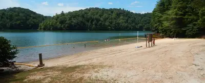
Goose Point Campground is nestled on the shores of Philpott Lake in the rugged foothills of Virginia's Blue Ridge Mountains. The clear water and natural shoreline make Philpott Lake a unique place for visitors.
Philpott Lake Virtual Tour: https://corpslakes.erdc.dren.mil/visitors/virtual/philpott/tour.html
From Overture Maps Foundation — Places, Recreation.gov, and Recreation.gov — campground rate cards · · Edit
Cell service
Report signal- Verizon4G LTE
- AT&T4G LTE
- T-Mobile4G LTE
Cell service at Goose Point: FCC map Dec 2025
Weather
National Weather Service
- TueSunny84°60°
- WedSunny, 1% chance of rain86°64°
- ThuMostly Sunny, 13% chance of rain76°63°
- FriSunny, 3% chance of rain82°46°
- SatSunny, 4% chance of rain58°37°
Nearby camping
SeeSee all on the map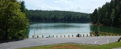
Salthouse Branch
Public Land · 1.2 mi · Bassett
Philpott Park
Public Land · 2.2 mi · Bassett
Horseshoe Point
Public Land · 2.4 mi · Ferrum
3 more within 25 mi
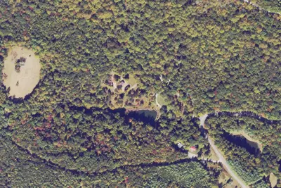
Location and contact
Data from Overture Maps Foundation — Places, Recreation Information Database (RIDB) / Recreation.gov, Recreation.gov — campground rate cards
Something wrong here? Suggest an edit
Run this campground? Claim the listing