Glory Hole Recreation Area
Angels, California · 1,161 ft · In New Melones
Photos: BOR
At a glance
5 of 8 facts known · recreation.gov, checked Sep 24, 2026
- Elevation
- 1,161 ft (354 m)1,161 ft354 m
Loops6
Pick a loop to see its sites.
- Big Oak 90-11223 sites23 standard · up to 80 ft
- Big Oak 113-13220 sites20 standard · up to 70 ft
- Big Oak 133-14412 sites12 standard · up to 60 ft
- Ironhorse 1-7, 23-44, 60-6938 sites38 standard · up to 90 ft
- Ironhorse 8-22, 70-7925 sites15 standard · 10 walk-to · up to 75 ft
- Ironhorse 45-59, 80-8925 sites15 standard · 10 walk-to · up to 70 ft
From recreation.gov's site list, Oct 10, 2026: 1 staff entry left out. Loop names are trimmed and merged.
Other campgrounds in New Melones 4
Nearest first. Every place inside the park's boundary.
- Acorn CampgroundCampground · facts not yet known2.4 mi
- Tuttletown Recreation Area9 loops · Acorn Sites 1-35, Acorn Sites 36-69, Chamise Sites 126-144, Chamise Sites 145-161, Eagle Point Group Picnic, Fiddleneck Group Site, Manzanita Sites 70-93, Manzanita Sites 94-125, Oak Knoll Group Site · $18–$22 a night · Reserve on Recreation.gov2.4 mi
- Chamise CampgroundCampground · facts not yet known2.7 mi
- Manzanita CampgroundCampground · facts not yet known2.9 mi
Also in the park: Group area: Fiddleneck Group Camp 2.5 mi · Group area: Oak Knoll Group Camp 2.7 mi
Open the park pageAmenities
From OpenStreetMap, Overture Maps Foundation — Places, Recreation.gov, Recreation.gov — campground rate cards · Correct
- Caravan / RV sites
- Dump station
- Showers
- Showers
- Tent sites
- Toilets
- Wheelchair accessible (limited)
From OpenStreetMap, Overture Maps Foundation — Places, Recreation.gov, Recreation.gov — campground rate cards
You could be the first camper hereYou could be the first camper on this page
Stayed here? Share what the next camper should know.
Free account · no email needed to browse
About
Overview
Glory Hole Recreation Area is located at New Melones Lake on the Stanislaus River. The 12,500 surface-acre lake is the fourth largest reservoir in California and is situated along the edge of the Mother Lode, the rich gold vein that prompted the California Gold Rush of 1849. At an elevation of 1100 feet, the diverse and resource-abundant Foothill Oak Woodlands hug the 100 miles of shoreline.
Popular activities on and around the large, yet uncrowded lake include fishing, boating, water skiing, wake boarding, jet skiing, sailing, swimming, kayaking, canoeing, wildlife viewing, rock climbing, hiking, biking, horseback riding and picknicking. The New Melones Visitor Center offers year-round interpretive events and a museum highlighting natural and cultural resources.Recreation
From OpenStreetMap, Overture Maps Foundation — Places, Recreation.gov, and Recreation.gov — campground rate cards · · Edit
Cell service
Report signal- Verizon4G LTE
- AT&T5G · 4G LTE
- T-Mobile5G · 4G LTE
Cell service at Glory Hole Recreation Area: FCC map Dec 2025
Weather
National Weather Service
- TueSunny71°52°
- WedSunny74°55°
- ThuSunny79°59°
- FriSunny83°59°
- SatSunny85°60°
Nearby camping
SeeSee all on the mapOutside the park, nearest first.
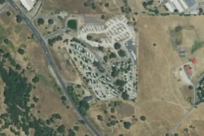
Angels Camp RV & Camping Resort
Campground · 2.7 mi · Angels
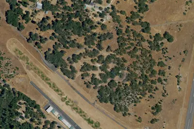
Columbia Airport Campground
Campground · 6.9 mi · Columbia
Chicken Ranch Casino
Overnight Parking · 7.2 mi · Jamestown
3 more within 25 mi
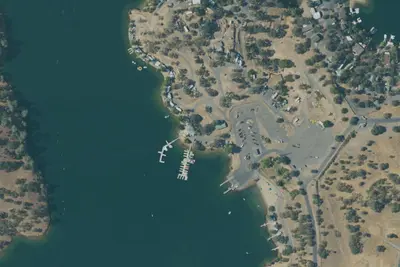
Dispersed camping nearby
Free dispersed camping within 19 mi, on public land.
Location and contact
Data from OpenStreetMap, Overture Maps Foundation — Places, Recreation Information Database (RIDB) / Recreation.gov, Recreation.gov — campground rate cards
Something wrong here? Suggest an edit
Run this campground? Claim the listing