Frank Gross Campground
Dahlonega, Georgia · 2,238 ft · In Chattahoochee-Oconee National Forest
Photos: USFS
At a glance
5 of 8 facts known · recreation.gov, checked Oct 3, 2026
- Elevation
- 2,238 ft (682 m)2,238 ft682 m
Sites8
Frank Gross Campground lists no loops, so its sites are listed here. Pick a site to see its details.
From recreation.gov's site list, Oct 10, 2026.
Amenities
From OpenStreetMap, Overture Maps Foundation — Places, Recreation.gov, Recreation.gov — campground rate cards, USDA Forest Service — Recreation Opportunities, USFS INFRA Recreation Sites · Correct
- Tent sites
- Hours (mar 17 - nov 29 00 00-24 00)
From OpenStreetMap, Overture Maps Foundation — Places, Recreation.gov, Recreation.gov — campground rate cards, USDA Forest Service — Recreation Opportunities, USFS INFRA Recreation Sites
You could be the first camper hereYou could be the first camper on this page
Stayed here? Share what the next camper should know.
Free account · no email needed to browse
About
Overview
Frank Gross is a U.S. Forest Service Campground located approximately 2 hours north of Atlanta in the North Georgia Mountains of the Chattahoochee National Forest. Frank Gross Campground offers visitors year-round recreation opportunities such as camping, fishing, picnicking, and hiking. Trout fishing is popular here in North Georgia so having a campsite such as Frank Gross adjacent to the Rock Creek is an amazing opportunity for avid fisherman. Eight campsites are neatly arranged for privacy and only walking distance to Rock Creek. Campsites 2 & 5 are directly next to the River. The climate here is fairly mild and generally offers all four seasons, so it's a wonderful place to relax and experience each of these throughout the year. North Georgia is a playground for wildlife watchers. We have an abundance of Deer, Turkey, Bear, and small Furbearers. If you need to get away from civilization and everyday life, please visit Frank Gross Campground. You'll be glad you did.
Recreation
We have plenty of recreational opportunities that are not far from Frank Gross. If you enjoy hiking, The Benton MacKaye trail is north of Frank Gross; this trail crosses the Toccoa River on a suspension bridge that is 260 feet long. Fishing in Rock Creek and Mill Creek for stocked and wild trout is popular. The Chattahoocee National Fish Hatchery is also located on Rock Creek approximately 1/4 mile downstream from Frank Gross. The facility offers an informational visitor kiosk, outdoor raceway viewing, picniking, and an Environmental Education Center. Hiking Trails within a 30 minute drive - The Appalachian Trail is approximately 4 miles south at the intersection of FS Road 42 and FS Road 69. The Benton MacKaye Trail crosses FS Road 333 approximately 4 miles north.
From OpenStreetMap, Overture Maps Foundation — Places, Recreation.gov, Recreation.gov — campground rate cards, USDA Forest Service — Recreation Opportunities, and USFS INFRA Recreation Sites · · Edit
Cell service
Report signalFCC map: no coverage reported
- VerizonNo coverage on FCC map
- AT&TNo coverage on FCC map
- T-MobileNo coverage on FCC map
Cell service at Frank Gross Campground: FCC map Dec 2025
Weather
National Weather Service
- WedSunny82°58°
- ThuSunny82°57°
- FriSunny, 1% chance of rain76°39°
- SatSunny62°38°
- SunSunny60°40°
Nearby camping
SeeSee all on the map
Camp site
Campground · 0.8 mi · Dahlonega
Camp site
Campground · 1.0 mi · Dahlonega
Camp site
Campground · 1.3 mi · Dahlonega
3 more within 25 mi
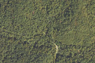
5 OpenStreetMap entries in Dahlonega share one park. They may be individual sites of a single campground. Suggest a merge
Dispersed camping nearby
Free dispersed camping within 19 mi, on public land.
- 2.1 mi
Camp site
Dahlonega, GA · On State agency land · Blue Ridge Wildlife Management Area
- 2.6 mi
A.T. Hawk Mountain Shelter
Dahlonega, GA · On State agency land · Blue Ridge Wildlife Management Area
- 3.5 mi
Noontootla Dispersed Area
Cherry Log, GA · On State agency land · Blue Ridge Wildlife Management Area
- 4.5 mi
A.T. Stover Creek Shelter
Dahlonega, GA · On State agency land · Blue Ridge Wildlife Management Area
- 5.1 mi
Montgomery Creek Dispersed Area
Dahlonega, GA
- 5.6 mi
A.T. Springer Mountain Shelter
Dahlonega, GA
Location and contact
Data from OpenStreetMap, Overture Maps Foundation — Places, Recreation Information Database (RIDB) / Recreation.gov, Recreation.gov — campground rate cards, USDA Forest Service — Recreation Opportunities, USFS INFRA Recreation Sites
Something wrong here? Suggest an edit
Run this campground? Claim the listing