Deerlodge Park Campground
In Dinosaur National Monument · Dinosaur, Colorado · 5,614 ft
Photos: NPS Photo
No reviews yet
At a glance
4 of 8 facts known · recreation.gov, checked Sep 24, 2026
- Elevation
- 5,614 ft (1,711 m)
Weather
Today
Mostly Sunny
77° / 48°
4%
Saturday
Sunny
78° / 49°
1%
Sunday
Partly Sunny
78° / 51°
1%
Monday
Showers And Thunderstorms Likely
70° / 48°
56%
Tuesday
Slight Chance Rain Showers then Partly Sunny
68° / 46°
22%
Source: National Weather Service
About
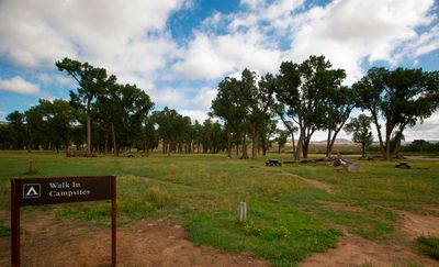
Overview Deerlodge Park Campground is located 51 miles (85 km) east of the Canyon Visitor Center and 80 miles (129 km) from the Quarry Visitor Center. The campground sits on the Yampa River by the boat ramp at the head of Yampa Canyon. Deerlodge Park Campground is open year-round, but winter access can be very difficult due to snow. When the Yampa River exceeds an 18,000 cfs flow rate, the campground will flood. This is typically during the late spring runoff. Before you camp at Deerlodge Park, check the USGS current Yampa River flow rates and the NOAA Yampa river predicted flow rates
Amenities
From Recreation Information Database (RIDB) / Recreation.gov · Add or correct
- Campfires allowed
You could be the first camper hereYou could be the first camper on this page
We know where it is and what the land is. Your stay fills in the rest. One sign-in unlocks everything below, and each one earns a badge.
Free account · no email needed to browse
Reviews
none yet
Nearby camping
See all on the map
Deerlodge Park Campground
Campground · Dinosaur, CO
Deerlodge Park Campground
National Park · Dinosaur, CO
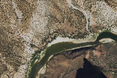
Anderson Hole River Camp
Dispersed · Maybell-Powder Wash, CO
3 more within 25 mi
5 OpenStreetMap entries in Dinosaur share one park. They may be individual sites of a single campground. Suggest a merge
Dispersed camping nearby
Free dispersed camping within 19 mi, on public land.
- 3.7 mi
Anderson Hole River Camp
Maybell-Powder Wash, CO · On National Park Service land · Dinosaur National Monument
- 6.5 mi
Ponderosa River Camp
Dinosaur, CO · On National Park Service land · Dinosaur National Monument
- 6.8 mi
Teepee Hole River Camp
Maybell-Powder Wash, CO · On National Park Service land · Dinosaur National Monument
- 16 mi
Big Joe River Camp
Maybell-Powder Wash, CO · On National Park Service land · Dinosaur National Monument
- 17 mi
Harding Hole River Camp 1
Dinosaur, CO · On National Park Service land · Dinosaur National Monument
- 17 mi
Harding Hole River Camp 2
Dinosaur, CO · On National Park Service land · Dinosaur National Monument
Details
Data from Recreation Information Database (RIDB) / Recreation.gov · Suggest an edit · Claim this listing
Cell Service
AT&T on the FCC map
Questions & Answers
none yet