Cottonwood Campground
Mount Laguna, California · 4,314 ft
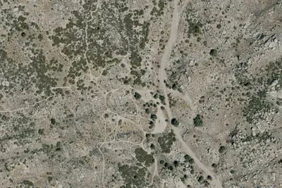
Aerial view · USGS / USDA NAIP · Public domain · source
Photos taken nearby
From Wikimedia Commons, taken close to this campground — not necessarily pictures of it.
At a glance
4 of 8 facts known · OpenStreetMap, checked Oct 3, 2026
- Elevation
- 4,314 ft (1,315 m)4,314 ft1,315 m
- Land
- El Centro Field Office
Bureau of Land Management
Amenities
From BLM National Recreation Sites & Facilities, OpenStreetMap, Recreation.gov · Correct
- Campfires allowed
- Campfires allowed
- Picnic tables
From BLM National Recreation Sites & Facilities, OpenStreetMap, Recreation.gov
You could be the first camper hereYou could be the first camper on this page
Stayed here? Share what the next camper should know.
Free account · no email needed to browse
About
Among the live oaks in southeastern San Diego County is Cottonwood Campground. The campground offers a tranquil and refreshing experience. Cottonwood Campground is an excellent starting point for day hikes, overnight backpacking trips, and equestrian use. The campground is located in the McCain Valley Resource Conservation Area. A trail out of the campground leads to the Sombrero Peak Area, Upper Bow Willow Canyon, and Anza-Borrego Desert State Park. The Pepperwood Trail and Sombrero Peak Trail are both rated moderate to strenuous. The trails are sandy in composition and meander through public, state, and private lands. Elevations range from 3,000 to 4,500 feet. This makes the area an excellent escape from the hot summer temperatures of lower elevations. Most precipitation is received from December through April. Thundershowers are common during July and August. Winter temperatures range from the 50s (F) to below freezing, with occasional snowfalls. Summer temperatures range from 60 to 95 degrees (F).Cottonwood Campground is a year-round facility with 25 developed campsites. Fire rings, tables, and vault toilets are found in the campground. Horses are allowed only in the east loop of Cottonwood Campground. No group camping sites are available. No off highway vehicle (OHV) use is permitted in Cottonwood Campground or on McCain Valley Road. A $6.00 per campsite fee is required for camping at all BLM campsites. All sites are available on a first come first served basis. Except for backpacking, all camping in McCain Valley must be in a designated campsite. A campfire permit may be required. Contact the California Department of Forestry and Fire Protection for regulations.
From BLM National Recreation Sites & Facilities, OpenStreetMap, and Recreation.gov · Edit
Cell service
Report signalFCC map: no coverage reported
- VerizonNo coverage on FCC map
- AT&TNo coverage on FCC map
- T-MobileNo coverage on FCC map
Cell service at Cottonwood Campground: FCC map Dec 2025
Weather
National Weather Service
- TueSunny56°48°
- WedSunny61°53°
- ThuSunny65°59°
- FriSunny, 2% chance of rain66°55°
- SatSunny, 1% chance of rain61°54°
Nearby camping
SeeSee all on the map
Camp site
Dispersed · 4.6 mi · Mount Laguna
Camp site
Dispersed · 4.8 mi · Mount Laguna
Campsite by large oak tree PCT
Campground · 4.8 mi · Mount Laguna
3 more within 25 mi
Dispersed camping nearby
Free dispersed camping within 19 mi, on public land.
- 4.6 mi
Camp site
Mount Laguna, CA · On U.S. Forest Service land · Cleveland National Forest
- 4.8 mi
Camp site
Mount Laguna, CA · On U.S. Forest Service land · Cleveland National Forest
- 4.9 mi
Camp site
Mount Laguna, CA · On U.S. Forest Service land · Cleveland National Forest
- 8.4 mi
Mountain Palm Springs Primitive Campground
Mount Laguna, CA · On State agency land · Anza-Borrego Desert State Park
- 17 mi
Blair Valley Primitive Campground
Julian, CA · On State agency land · Anza-Borrego Desert State Park
Location and contact
Data from BLM National Recreation Sites & Facilities, OpenStreetMap, Recreation Information Database (RIDB) / Recreation.gov
Something wrong here? Suggest an edit
Run this campground? Claim the listing