Coalmine Hill Campground
Heppner, Oregon · 4,846 ft
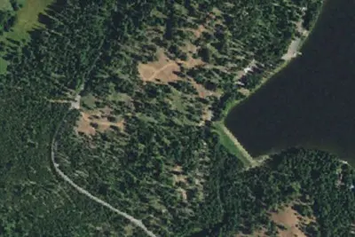
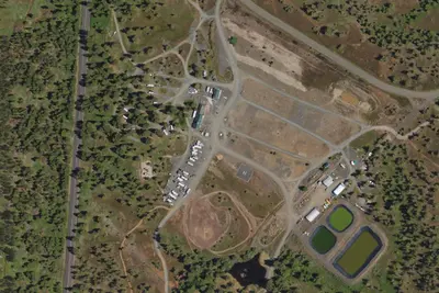
Aerial view · USGS / USDA NAIP · Public domain · source
At a glance
3 of 8 facts known · Forest Service data, checked Oct 3, 2026
- Elevation
- 4,846 ft (1,477 m)4,846 ft1,477 m
- Land
- Umatilla National Forest
U.S. Forest Service
Amenities
You could be the first camper hereYou could be the first camper on this page
Stayed here? Share what the next camper should know.
Free account · no email needed to browse
About
Coalmine Hill is just off the paved Blue Mountain Scenic Byway (also called the Western Route). The Campground serves as access to the Bald Mountain, Hells Half Acre, and Willow Creek trails, offering a 7.5 mile-long loop experience for hikers and equestrians. Once inside the campground 's large parking area, there is an information board on the northeast side. Past the information board runs the Bald Mountain hiking trail leading to Gibson Cave, which is 1.25 miles from the parking lot. The cave is really a shallow overhanging shelter with an interpretive; sign describing its history.Once you 've reached Gibson 's cave, continue up the Bald Mountain trail until you reach a nice view point. The mountain 's view point overlooks the drainages in between Coalmine Hill (to the northwest) and Little Bald Mountain (to the east), providing fantastic views and tranquility. About five miles southwest of the campground is Penland Lake; follow the Blue mountain Scenic Byway and Forest Service Road 21 and 2103, until you 've reached Penland Lake where there are fishing and nonelectric boating opportunities. . Coalmine Hill Campground provides one larger, separate site near the entrance and the remaining five sites are located along the tree edges of the large parking area. There is one vault toilet and a travel access information board. This campground was constructed to serve double-duty as a snow park in the winter. There is no potable water or garbage service, so please pack out all garbage and dispose of it at home.
Fees: No fees are required for this site
From OpenStreetMap, USDA Forest Service — Recreation Opportunities, and USFS INFRA Recreation Sites · Edit
Cell service
Report signal- VerizonNo coverage on FCC map
- AT&T5G · 4G LTE
- T-MobileNo coverage on FCC map
Cell service at Coalmine Hill Campground: FCC map Dec 2025
Weather
National Weather Service
- WedAreas Of Frost then Mostly Sunny, 3% chance of rain54°36°
- ThuSunny61°44°
- FriSunny67°44°
- SatMostly Sunny57°34°
- SunMostly Sunny, 1% chance of rain54°36°
Nearby camping
SeeSee all on the map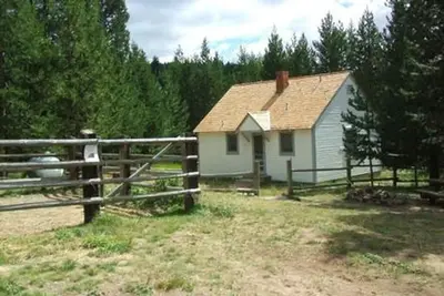
Location and contact
Data from OpenStreetMap, USDA Forest Service — Recreation Opportunities, USFS INFRA Recreation Sites
Something wrong here? Suggest an edit
Run this campground? Claim the listing