Camp Creek Campground
Zortman, Montana · 4,026 ft
Aerial view · USGS / USDA NAIP · Public domain · source
At a glance
2 of 8 facts known · from OpenStreetMap and USGS
- Elevation
- 4,026 ft (1,227 m)4,026 ft1,227 m
- Land
- Malta Field Office
Bureau of Land Management
Amenities
You could be the first camper hereYou could be the first camper on this page
Stayed here? Share what the next camper should know.
Free account · no email needed to browse
About
Camp Creek Recreation Area, located in the scenic Little Rockies, consists of Camp Creek Campground, Horse Corral Campground, and Buffington Day Use Area. A system of trails leads from the main campground, making this a popular destination for hikers, birders and OHV enthusiasts. Several small bass and trout fisheries are located within 30-minutes drives. The nearby town of Zortman offers a store, restaurant, fuel, and gold panning opportunities. This is a Watchable Wildlife area as well as a featured stop on Montana's Northeastern Plains Birding Trail. Highlighted species include Clark's nutcracker, red crossbill and red-naped sapsucker.
Facilities/Services:
From BLM National Recreation Sites & Facilities and Recreation.gov · · Edit
Cell service
Report signal- Verizon4G LTE
- AT&TNo coverage on FCC map
- T-MobileNo coverage on FCC map
Cell service at Camp Creek Campground: FCC map Dec 2025
Weather
National Weather Service
- TueSunny44°27°
- WedSunny, 2% chance of rain54°34°
- ThuMostly Sunny50°36°
- FriSunny64°48°
- SatMostly Sunny68°42°
Nearby camping
SeeSee all on the map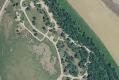
Location and contact
Data from BLM National Recreation Sites & Facilities, Recreation Information Database (RIDB) / Recreation.gov
Something wrong here? Suggest an edit
Run this campground? Claim the listing