Calpine Lookout
Calpine, California · 5,863 ft · In Tahoe National Forest
Wildfire 26 mi E: Bull, 1,529 acres, 98% contained
At a glance
4 of 8 facts known · recreation.gov, checked Sep 24, 2026
- Elevation
- 5,863 ft (1,787 m)5,863 ft1,787 m
Loops1
Pick a loop to see its sites.
From recreation.gov's site list, Oct 10, 2026. Loop names are trimmed and merged.
Amenities
From Recreation.gov, Recreation.gov — campground rate cards · Correct
- Cell signal reported
- Toilets
From Recreation.gov, Recreation.gov — campground rate cards
You could be the first camper hereYou could be the first camper on this page
Stayed here? Share what the next camper should know.
Free account · no email needed to browse
About
Overview
Calpine is a forest fire lookout tower that was constructed in 1934 by the Civilian Conservation Corps, and is one of three remaining examples of the enclosed windmill-style lookout in California. The lookout was actively used every summer until 1975. It is a three-story structure with external stairs. The top room or observation cab is the only rentable space at this time. This is a popular rental facility that is booked almost every night of the year.
Calpine sits at an elevation of 5,980 feet in the Sierra Nevada Mountains of the Tahoe National Forest, approximately 40 miles from Truckee, California. During the summer, renters can drive directly to the base of the tower. In winter, the road is often closed due to snow and ice so access is by snowshoes, skis or snowmobile.
From Recreation.gov and Recreation.gov — campground rate cards · · Edit
Cell service
Report signal- Verizon4G LTE
- AT&TNo coverage on FCC map
- T-Mobile5G · 4G LTE
Cell service at Calpine Lookout: FCC map Sep 2026
Weather
National Weather Service
- ThuSunny67°36°
- FriSunny73°36°
- SatSunny73°36°
- SunSunny69°34°
- MonMostly Sunny, 2% chance of rain62°32°
Nearby camping
SeeSee all on the map
Beartrap
Dispersed · 3.6 mi · Sattley
Chapman
Dispersed · 4.3 mi · Calpine
Yuba Pass Campground
Public Land · 4.6 mi · Sattley
3 more within 25 mi
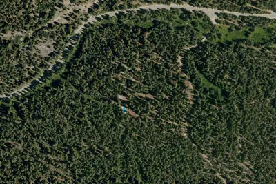
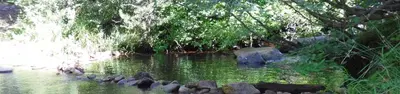
3 OpenStreetMap entries in Calpine share one park. They may be individual sites of a single campground. Suggest a merge
Nearby
The closest of each, in a straight line from here.
Dispersed camping nearby
Free dispersed camping within 19 mi, on public land.
Location and contact
Data from Recreation Information Database (RIDB) / Recreation.gov, Recreation.gov — campground rate cards
Something wrong here? Suggest an edit
Run this campground? Claim the listing