Buffumville Lake (Group Shelter)
Oxford, Massachusetts · 515 ft · In Buffumville Lake
Photos: USACE
At a glance
4 of 8 facts known · recreation.gov, checked Sep 24, 2026
- Elevation
- 515 ft (157 m)515 ft157 m
Sites1
Buffumville Lake (Group Shelter) lists no loops, so its sites are listed here. Pick a site to see its details.
All 1 shown · by site number
From recreation.gov's site list, Oct 10, 2026.
Amenities
From Recreation.gov, Recreation.gov — campground rate cards · Correct
- ADA accessible
- Drinking water
- Toilets
From Recreation.gov, Recreation.gov — campground rate cards
You could be the first camper hereYou could be the first camper on this page
Stayed here? Share what the next camper should know.
Free account · no email needed to browse
About
Overview
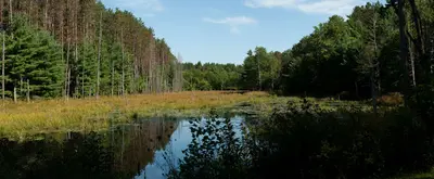
In 1958 the U.S. Army Corps of Engineers built Buffumville Dam in Charlton, Massachusetts to provide flood risk management for downstream communities. Flood waters due to large amounts of rainfall or spring snow melts are stored on 480 acres of land. The lake is also managed for recreation and environmental stewardship. Buffumville offers year-round recreation and park rangers are available to assist you during your visit. Recreation
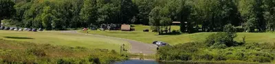
Buffumville Lake provides excellent boating, canoeing, fishing, hiking and swimming opportunities. Hikers and bikers enjoy exploring the 7.2-mile Lake Shore Trail, which begins at the beach and circles the lake. Scenic and wildlife viewing opportunities are plentiful along the trail. The Buffumville Lake Disc Golf Course has an 18 hole professional layout and a 12 hole amateur layout that wind through the scenic project lands. The hilly terrain contains a mixture of open fairways, woods and water hazards. A concrete boat launch and courtesy dock allows boat access to the lake. Both sides of the lake are accessible by a twelve foot wide culvert under Oxford Road and there are no motor horsepower restrictions on the lake. Two barrier free fishing platforms are located within the boat launch area. Dogs are allowed in project recreation areas and shall be on a leash under six feet in length.
From Recreation.gov and Recreation.gov — campground rate cards · · Edit
Cell service
Report signal- Verizon4G LTE
- AT&T4G LTE
- T-MobileNo coverage on FCC map
Cell service at Buffumville Lake (Group Shelter): FCC map Dec 2025
Weather
National Weather Service
- WedPatchy Fog then Slight Chance Rain Showers, 20% chance of rain74°46°
- ThuSunny61°43°
- FriRain Showers, 98% chance of rain65°38°
- SatMostly Sunny, 6% chance of rain47°31°
- SunSunny55°36°
Nearby camping
SeeSee all on the mapWalmart · North Oxford
Overnight Parking · 3.7 mi · Oxford
Camp Laurelwood
Campground · 5.3 mi · Spencer
Walmart · Sturbridge
Overnight Parking · 7.8 mi · Sturbridge
3 more within 25 mi
Location and contact
Data from Recreation Information Database (RIDB) / Recreation.gov, Recreation.gov — campground rate cards
Something wrong here? Suggest an edit
Run this campground? Claim the listing