Buckhorn Campground
Sulphur, Oklahoma · 886 ft · In Chickasaw National Recreation Area
Photos: NPS
Wildfire 29 mi W: Fox Field, 10 acres
At a glance
4 of 8 facts known · nps.gov, checked Sep 24, 2026
- Elevation
- 886 ft (270 m)886 ft270 m
- Land
- Chickasaw National Recreation Area
National Park Service
Loops3
Pick a loop to see what's known about it. Each loop is mapped on OpenStreetMap.
| Loop | Sites | Longest rig | Open |
|---|---|---|---|
| Loop A | Not yet known | Not yet known | |
| Loop B | Not yet known | Not yet known | |
| Loop D | Not yet known | Not yet known |
Camped at Buckhorn Campground? Add a loop's sites and the next camper sees them here
This campground was listed as 3 places, Buckhorn Campground Loop A, Buckhorn Campground Loop B and Buckhorn Campground Loop D. All the old links open this page.
Other campgrounds in Chickasaw National Recreation Area 10
Nearest first. Every place inside the park's boundary.
- Buckhorn Campground (Chickasaw)5 loops · Loop A, Loop B, Loop C, Loop D, Scan and Pay · 41 sites · $20–$30 a night · full hookups · Reserve on Recreation.gov0.1 mi
- Buckhorn Campground2 loops · Loop B and Loop D · 25 sites · $16 a night · partial hookups0.3 mi
- camping 16-25$Campground · facts not yet known0.5 mi
- Goddard Youth CampCampground · facts not yet known0.7 mi
- The Point Campground (Chickasaw)55 sites · $20–$30 a night · partial hookups · Reserve on Recreation.gov2.8 mi
- Guy Sandy Campground40 sites · $14 a night4.1 mi
Also in the park: Group area: Rock Creek Group Camp (Chickasaw) 4.6 mi · Group area: Central Group Camp (Chickasaw) 5.3 mi
Open the park pageAmenities
You could be the first camper hereYou could be the first camper on this page
Stayed here? Share what the next camper should know.
Free account · no email needed to browse
About
Buckhorn Campground has four loops. Loop A is open seasonally on a first come, first served basis. There are no hookups for RVs on Loop A. Located next to Lake of the Arbuckles, Buckhorn Campground is also located near the Buckhorn Boat Launch and near the southern trailhead for the Rock Creek Multi-Use Trail.
From National Park Service — campgrounds, OpenStreetMap, and Recreation.gov · Edit
Cell service
Report signal- Verizon5G · 4G LTE
- AT&T5G · 4G LTE
- T-Mobile4G LTE
Cell service at Buckhorn Campground: FCC map Dec 2025
Weather
National Weather Service
- TuePartly Sunny, 6% chance of rain87°74°
- WedShowers And Thunderstorms Likely, 57% chance of rain89°69°
- ThuChance Showers And Thunderstorms, 54% chance of rain84°57°
- FriSlight Chance Rain Showers then Mostly Sunny, 16% chance of rain66°47°
- SatMostly Sunny67°46°
Nearby camping
SeeSee all on the mapOutside the park, nearest first.
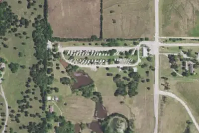
Arbuckle RV Resort
Campground · 4.6 mi · Sulphur
Walmart · Sulphur
Overnight Parking · 5.2 mi · Sulphur
Casino
Overnight Parking · 5.5 mi · Sulphur
3 more within 25 mi
Location and contact
Data from National Park Service — campgrounds (NPS Data API), OpenStreetMap, Recreation Information Database (RIDB) / Recreation.gov
Something wrong here? Suggest an edit
Run this campground? Claim the listing