Big Flat Dispersed Camping
Circleville, Utah · 10,197 ft
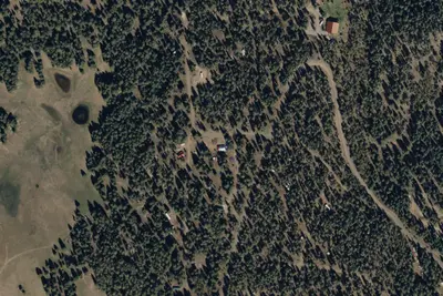
Aerial view · USGS / USDA NAIP · Public domain · source
At a glance
3 of 8 facts known · Forest Service data, checked Oct 3, 2026
- Elevation
- 10,197 ft (3,108 m)10,197 ft3,108 m
- Land
- Fishlake National Forest
U.S. Forest Service
Amenities
You could be the first camper hereYou could be the first camper on this page
Stayed here? Share what the next camper should know.
Free account · no email needed to browse
About
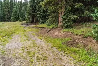
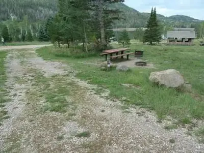
The Big Flat dispersed camping area is a favorite recreational spot anytime of the year because of the spectacular scenery. ATV riders can access the Paiute ATV trail from dispersed camping sites. Many non-motorized trails are also accessable to hiking and horse riding. This area also offers winter sport opportunities such as snowmobiling and cross-country skiing. Common vegetation includes Engelmann spruce, aspen and fir. The general terrain is a large meadow encompassed by aspen and mixed conifer trees. This area is open to ATV use on designated routes only. Please help prevent erosion and soil compaction by staying on roads and motorized trails. Driving on the meadows creates ruts or channels that water flows down removing topsoil and creating scars that last many lifetimes. Also, delicate meadow plants can be damaged leaving less forage for wildlife and leaving the soil unprotected. When riders drive through the trees and around them in circles the soil becomes compacted, depriving root systems of water and air, this will eventually kill the tree.
From USFS INFRA Recreation Sites · Edit
Cell service
Report signal- Verizon4G LTE
- AT&T4G LTE
- T-MobileNo coverage on FCC map
Cell service at Big Flat Dispersed Camping: FCC map Dec 2025
Weather
National Weather Service
- TueSnow Showers, 87% chance of rain28°25°
- WedScattered Snow Showers, 35% chance of rain30°24°
- ThuSunny, 4% chance of rain40°28°
- FriSunny, 1% chance of rain44°31°
- SatSunny, 1% chance of rain46°33°
Nearby camping
SeeSee all on the mapBig Flat Guard Station Cabin
Other · 1.9 mi · Junction
LeBaron Campground
Public Land · 2.7 mi · Circleville
LeBaron Lake
Public Land · 2.7 mi · Circleville
3 more within 25 mi
3 OpenStreetMap entries in Circleville share one park. They may be individual sites of a single campground. Suggest a merge
Location and contact
Data from USFS INFRA Recreation Sites
Something wrong here? Suggest an edit
Run this campground? Claim the listing