Backbone Rock Campground
Damascus, Tennessee · 2,152 ft · In Cherokee National Forest
Photos: US Forest Service
At a glance
5 of 8 facts known · recreation.gov, checked Sep 24, 2026
- Elevation
- 2,152 ft (656 m)2,152 ft656 m
Sites11
Backbone Rock Campground lists no loops, so its sites are listed here. Pick a site to see its details.
- 01Standard · accessible · up to 5 people
- 02Standard · accessible · up to 5 people
- 03Standard · accessible · up to 10 people
- 04Standard · accessible · up to 5 people
- 05Standard · accessible · up to 5 people
- 06Standard · accessible · up to 5 people
- 07Standard · accessible · up to 5 people
- 08Standard · accessible · up to 10 people
- 09Standard · accessible · up to 5 people
- 10Standard · accessible · up to 5 people
Showing 10 of 11 · by site number
From recreation.gov's site list, Oct 10, 2026.
Amenities
From OpenStreetMap, Recreation.gov, Recreation.gov — campground rate cards, USDA Forest Service — Recreation Opportunities, USFS INFRA Recreation Sites · Correct
- ADA accessible
- Campfires allowed
From OpenStreetMap, Recreation.gov, Recreation.gov — campground rate cards, USDA Forest Service — Recreation Opportunities, USFS INFRA Recreation Sites
You could be the first camper hereYou could be the first camper on this page
Stayed here? Share what the next camper should know.
Free account · no email needed to browse
About
Overview
Backbone Rock Campground will open for the 2026 season on 4/27/26. The pavilion and vault toilets in the day-use area will open on 3/16/26. Backbone Rock is a small campground situated along the beautiful Beaverdam Creek at an elevation of 2,100 feet in northern Johnson County. This developed campground is popular with those visiting the nearby Backbone Rock, a tunnel originally blasted through the rock ridge for the railway. The creek side location with popular swim area and lush forest surroundings make Backbone Rock Campground particularly desirable during hot summer months. With 10 campsites and an adjacent large Civilian Conservation Corps- built reservable pavilion with lawn, Backbone Rock is a great option for a group to reserve the whole campground for retreats and other events.
Recreation
Along with camping, Beaverdam Creek is stocked with trout. The Appalachian National Scenic Trail is accessed via the Backbone Rock Trail (#53).
From OpenStreetMap, Recreation.gov, Recreation.gov — campground rate cards, USDA Forest Service — Recreation Opportunities, and USFS INFRA Recreation Sites · · Edit
Cell service
Report signalFCC map: no coverage reported
- VerizonNo coverage on FCC map
- AT&TNo coverage on FCC map
- T-MobileNo coverage on FCC map
Cell service at Backbone Rock Campground: FCC map Dec 2025
Weather
National Weather Service
- WedSunny, 1% chance of rain76°61°
- ThuMostly Sunny then Slight Chance Rain Showers, 16% chance of rain77°62°
- FriRain Showers, 75% chance of rain70°39°
- SatMostly Sunny, 4% chance of rain51°33°
- SunSunny59°37°
Nearby camping
SeeSee all on the map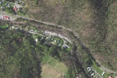
Laurel Creek RV Park
RV Park · 3.2 mi · Damascus
A.T. Abington Gap Shelter
Public Land · 4.9 mi · Damascus

Saunders A.T. Shelter
Public Land · 6.4 mi · Damascus
3 more within 25 mi
Location and contact
Data from OpenStreetMap, Recreation Information Database (RIDB) / Recreation.gov, Recreation.gov — campground rate cards, USDA Forest Service — Recreation Opportunities, USFS INFRA Recreation Sites
Something wrong here? Suggest an edit
Run this campground? Claim the listing